Monday, August 31, 2009

Day One Hundred Eighty-three, 090830 - Grand Rapids, MN

Day One Hundred Eighty-three, Date Sunday, August 30, 2009
Time in Saddle: 7:56
Distance for the Day: 76.29 miles From Proctor To Grand Rapids, MN
Accumulated Trip Distance: 8981.4 miles
Altitudes: Starting/Ending 990’/987’, Highest: 1111’ Accumulated: 1430’
Speeds: Avg: 9.6 mph, Max: 26.1 mph
Weather: 35° clear except high, light cirrus, warming to low 70s and small cumulus
Expenditures: $22

I woke up at 5:50am this morning, got up at 6am, and was broke down by 6:35am. It was pretty cold, with temps getting close to freezing, very clear skies with a bit of high cirrus, and beautiful Venus. The moisture was high, with a lot of dew on everything. I went to the mini mart in town to get some breakfast, refill my water bottles, and stock up a bit ($6) until 7:35am and left Proctor, WI along the way I was heading when I first came into town the day before. However, I noticed from the sun that I could now see, that I was heading southeast. I knew that there should be no southeast component of my route at this point, so I stopped in at the handily nearby America Inn at 8am to 8:45am to recharge my notebook and reconnoiter. It was then I found out my error from the day before, and figured out what I had to do to correct it. I phoned Auntie M and had our weekly chat (she doesn’t have a computer or internet, so can only find out what I’m up to by phone), and then I backtracked to Adolph, to get back on route. Along the way, I found somebody’s wallet with credit cards and driver license. I also found a cell phone I could call, so I called him and left a message that I had his wallet and to leave me a message. I kept going and going, but didn’t hit any towns large enough to have viable lunch spots, so, getting kind of hungry and needing to take a pee, I stopped off the highway from 1:30pm – 2pm at a railroad switch track (East Switch Floodwood), took my pee, and set out my tarp, tent, and tent fly to them dry, and ate a banana, a bag of choco peanuts, and had a cheese/meat stick. After my stuff was dry and re-packed, I took off and almost immediately hit the town of Floodwood, which had mini marts and even a Subway, but now I wasn’t hungry! So, I decided to wait until I got to Grand Rapids to find the Subway, there. I did stop at another small town along the way to stock up on drinks and supplies ($13). Then, Hwy 2 became a little kinder, and a little more cruel, too; its shoulder became wider and smoother, but now it had endless miles of expansion joints – the big, deep ones, that make you go ka-THUNK, ka-THUNK, every several seconds. The road was actually newly repaved, with a clean, smooth, black resurface laid over it, but they left the shoulders as they were. I hate it when they do that. It got so annoying, I took to watching the rear traffic for clear periods, and would ride out onto the roadway to avoid the joints for a little while, until upcoming traffic would show up, and I would move back onto the shoulder, again (ka-THUNK). I pulled out my iPod, and found that listening to music helped me to ignore the repetitive jarrings a lot, so I gaily rode into Grand Rapids at about 6:30pm. I found the Subway, got a meal deal ($8), recharged my phone and notebook, and did some blog writeups until about 9pm. I also checked my phone messages, and the guy whose wallet I found left me a home phone number, so I called and we figured out that I should mail his wallet to him. When I finally left the Subway, a bunch of teenagers in a car got interested in my trike and story, so we chatted a bit, and then I left. It was dark, now, but thanks to the Street Atlas 2009 mapping program, I knew where the library was, and figured I could hole up near there for the night. Indeed, I found a very nice site: a large, open outdoor tent, kind of like a band shell, in a park right next to the library (N47 13.904’ W93 31.455’). I put my tent up inside this big tent that had a clean concrete floor, and hopped in with a Squirt soda, trailmix, and book at about 9:40pm. I read for a short while, and then went to sleep. There was some kind of industrial plant nearby, which made a constant white noise, but it wasn’t a bother (thanks to earplugs).

Day One Hundred Eighty-two, 090829 - Proctor, MN

Day One Hundred Eighty-two, Date Saturday, August 29, 2009
Time in Saddle: 8:30
Distance for the Day: 73.12 miles From Iron River To Proctor, MN
Accumulated Trip Distance: 8509.2
Altitudes: Starting/Ending 1050’/990’, Highest: 1120’ Accumulated: 2333’
Speeds: Avg: 8.6 mph, Max: 31.7 mph
Weather: 45° cold, overcast all day, with bouts of light rain, drizzle, mist, etc.
Expenditures: $

I woke up at 5:52am and got up at 6:10am. It was a bit chilly this morning, but at least most everything was dry; the trees stopped dripping, and the remnants of paved road were dry. I broke down and packed away my gear. The sky was overcast – didn’t quite look like it would rain at the moment, but then again, the day was young. There was two slugs and one daddy long legs on my ground tarp, but that was it. The song in my head this morning was Bob Seger’s, “Against The Wind.” By 7:06am I was ready to roll on Hwy 2 with the shoulder that barely fits me, but at least it’s not raining. Yet.

I stopped in Iron River from 8:45am – 9:18am at a mini mart to have breakfast of choco milk, Danish, and muffin + some food items ($11). I tried calling Auntie M, but the cell signal was too weak here, and she couldn’t hear me, though I could hear her just fine – weird. I’d try again, tomorrow. There was some clear sky way ahead of me, but that closed up and it started looking a little more threatening. Continued on towards Duluth, pumping away on the mostly level terrain through the dull, gray day. Stopped for a quick lunch from 12-12:24pm – I just had the 2nd half of my Subway sandwich, a soda, and read my book. Then continued on. I only got to see some clear sky off in the distance at about 5:30pm, otherwise, it was totally overcast, misty, cold and kind of nasty – enough to wear the rain gear but just barely. Ugh! I didn’t know it until the next day, but from the town of Adolph, I took an accidental three-mile southeast detour from my northwest route and entered the town of Proctor, MN. (When I can’t see the sun, my sense of direction can easily be lost.) I spoke with a local about possible stealth campsites, and he suggested the town’s athletic fields complex just down the street, by their civic center. Wow, there were several fields, with bleachers, lights – the works. For this tiny little town that was only about a quarter-mile long and had two whole gas stations, this seemed a bit excessive. Nevertheless, at about 7:30pm, just before sunset, I found my stealth camp. Everywhere was wet from all the rain and drizzle of the day, but there was a bathroom building with eves and dry walkways around it (N46 44.113’ W92 13.648’), so I set up my tent on the dry concrete, there (I love dry concrete). I hopped in with a bag of Frito’s chips, a lemonade, trail mix, and my book, and ate, drank, and read until 9pm, when I went to sleep. Unfortunately, this site also had a couple of bright, orange sodium vapor lights right above me, but I just pulled my knit cap over my eyes, and it was okay. I had a couple of visits from trucks passing by, but they didn’t bother me, or alert anyone, so I was okay.

Day One Hundred Eighty-One, 090828 - Iron River, WI

Day One Hundred Eighty-one, Date Friday, August 28, 2009
Time in Saddle: 5:49
Distance for the Day: 57.75 miles From Hurley To Iron River, WI
Accumulated Trip Distance: 8832.0 miles
Altitudes: Starting/Ending 1336’/1050’, Highest: 1342’ Accumulated: 1224’
Speeds: Avg: 9.9 mph, Max: 31.6 mph
Weather: 56° foggy w/overcast becoming rainy before noon, but stopping by mid afternoon, remaining overcast with threat of rain still
Expenditures: $45

I woke up at 5:15am and got up at 5:35am. It was overcast, this morning, and still fairly dark out. Strangely, there were no mosquitoes around, even though it wasn’t cold, and there was vegetation around, which they seem to like. Maybe these guys sprayed. Around the front of this construction business building I was behind, I could hear cars starting to drive up, and people talking. Oops! I broke down quietly, figuring my chances were good that no one would come back here for anything, and if I was really lucky, when I pulled out, no one would be outside to observe my departure. And that’s exactly what happened – I rolled out from behind the building at 6:20am, and down the hill to the highway, without seeing or being seen by anybody. By luck, I timed it just right – how nice! Today was a rain day (ugh!). It started out overcast, but dry, and then as I headed west, I could see the bands of dark clouds ahead and hoped they would break up and dissipate. Hah! It was also an easy, long downhill most of the morning, dropping from an altitude of about 1200’ ASL to less than 600’ ASL, resulting in quite a bit of ground covered in a relatively short time. I stopped at a mini mart for a breakfast of carrot cakes and choco milk ($4) between 9am and 10am, reading my new book. The rain was light and intermittent, at first, and I put on and took off my rain gear twice, before it really started to come down when I hit the town of Ashland, WI at around 11am. I hid under an out-of-business gas station pump island roof for a while, waiting for it to lighten up some, then continued on into Ashland’s business sector. I looked for and found a Subway store at noon, and stopped there to charge up my notebook and get today and tomorrow’s lunch + a snack ($12); spent 4.5 hours there, blogging, and waiting for the rain to stop, which it did, but it stayed overcast, with chance of rain still possible (yech!) I left to find the local bicycle shop in Ashland, Bay City Cycles (which Street Atlas 2009 found for me), to see if they had lightweight gloves to replace the ones I’d lost – they didn’t have those, but they *did* have the small, reflective triangles I’d been looking for since the Blue Ridge Parkway! He had three in stock, and I bought all three ($39 for 3), and planned to mount them on my panniers the first chance I got. Not loving the prospects for a dry campsite for the evening, I continued on out of Ashland at 3:52pm to try and get as much extra mileage I could for the day before nightfall. Along the way, I found a road towards a national park campground – they’re usually pay-for, but I’ve had luck finding stealth campsites on the road to campgrounds, before, so I took that road, and indeed, I found an offshoot road that of broken pavement that looked promising. It was still a bit early, but I wanted to find a decent campsite, and didn’t want to still be looking while on the somewhat narrow shoulder of Hwy 2 with big rigs roaring past at dusk – “git while the gittin’s good,” as they say. (N46 32.715’ W91 16.770’) It was about 6pm when I found the site, and I was set up and in bed by 6:45pm. The sky was misting, the trees were dripping, and I could faintly hear traffic off in distance. I hopped in, ate trailmix, drank Gatorade, and read my book until 9pm, but didn’t get to sleep until about 10pm because the sound of water dripping on my tent was too loud to ignore. A truck passed by twice – it paused to check me out, and kept on going without comment. I finally put in the earplugs for the dripping noise, and that was that. Zzzzzzzz.

Day One Hundred Eighty, 090827 - Hurley, WI

Day One Hundred Eighty, Date Thursday, August 27, 2009
Time in Saddle: 8:44
Distance for the Day: 86.01 miles From Covington To Hurley, WI
Accumulated Trip Distance: 8774.3 miles
Altitudes: Starting/Ending 1462’/1336’, Highest: 1467’ Accumulated: 1863’
Speeds: Avg: 9.8 mph, Max: 28.8 mph
Weather: 48° partly cloudy, warming to the low 70s
Expenditures: $21

I woke up at 6am and got up at 6:15am, broke down and was ready to roll by 6:53am. The sky was partly cloudy with band of high stratus to the SE, and I saw bright beautiful Venus shining in the light, pre-dawn blue. The crows were cawing, and I also heard a deer hasping its weird call – like someone with tonsillitis trying to shout, “hey!” I ate a quickie breakfast of grapefruit juice and trailmix, and then took off at just about 7am. Oops, unfortunately, the praise I laid on the State of Michigan’s roads just got a black eye: a 20 or 30 mile section of the road I was on, today, which had an otherwise decent shoulder, was *ruined* by a vibration strip. This forced me to put two tires into the main roadway, and I then had to keep a constant watch on traffic coming from behind, to dodge into the gravel off the edge of the shoulder when circumstances warranted. What a shame – they’d done so well for so long.

Stopped at Bruce Crossing to buy drinks and bananas ($5), and found a shady spot off the road to eat lunch (Subway sandwich, soda and trailmix). The sky cleared up, and the sun was warm, though the air was still very temperate. I continued on at 12:36pm towards Hurley, and the Michigan/Wisconsin border. A few notes: little bugs sometimes fly into my glasses, and are very annoying as they crawl around the inside of the lenses and on my eyelids. I have to take off my glasses and blow or poke em out with my finger. Also, every day, pains turn on in my knees or legs, but I can reduce them or even make them go away if I change the way I pedal. I can reduce the amount of ‘push’ pressure, and increase the amount of ‘pull’; or, I can point my toes, or press on the left or right side of my foot, or use the “heel-toe” stroke (aka, the “girly wave”), or the “come hither” pelvic tilt (where I twist my hip from side to side to get a little extra extension for each push – I’ve never seen it from a bystander’s point of view, but I imagine it must look almost ridiculously sexy). There are also slight variations of these actions which can be done to reduce the pain, but sometimes, nothing works. So, I have to either just grin and bear it, if it’s not too bad, or stop and rest a while if I can’t takes it no more – resting always helps a lot.

The terrain for hours and hours has been mostly flat with forest, or grassy hills, farms – very pleasant! I hope it stays this way all the way to the NW Angle (hah!) I crossed into Central Time (progress!), so what was 4pm is now 3pm. As I continued west on Hwy 28 in Wisconsin, it seemed to me that the frequency that cars coming from fore and aft converge with me is amazing – it seems to practically be a choreographed conspiracy. I can go for minutes at a time without any traffic at all, and then, two cars will show up on both horizons, front and back, and then all three of us pass each other at the same time. This, or variations of it, happens quite a bit, and seems to me that it happens more often than mere chance should allow. Stop it!
I stopped at mini mart at 2:30pm for ice cream and drink ($4); my right foot’s front tendon got sore, so I read my book for about a half hour to let it rest, and got back on the road at 3:10pm. That seemed to do the trick – by favoring my right foot a bit, the pain never came back – no need for ice or drugs; another one of those pains that came and went. I find that it helps to set the gearing so that it’s almost too easy to pedal, but not quite, to keep stress-induced pains from happening. Unfortunately, at this point in the trip, my knees appear to be more sensitive to stress than they were earlier. This is a bit of a concern, as I still have the Rockies to cross. I stopped in the town of Wakefield at 4:22pm for food and drinks ($6), and continued on at 4:40pm, and had a burger and fries dinner at Burger King ($6), while charging up my notebook. I continued on and switched from SR 28 to Hwy 2 on my way towards Hurley, where I passed from MI to WI at 7pm. The sun was quite low by the time I finished, so I rode a short way out of town before finding finding a stealth camp at 7:15pm on a side road off of Hwy 2 behind a large construction business building. I was set up and in bed by about 8:15pm. Someone did drive up, but left again without noticing me;; N46 28.258’ W90 11.967’ read book until too dark to read, forgot my earplugs, so had to get up to get them, got to sleep around 11pm (10pm Eastern time, which I must still be used to).

Day One Hundred Seventy-nine, 090826 - Covington, MN

Day One Hundred Seventy-nine, Date Wednesday, August 26, 2009
Time in Saddle: 8:27
Distance for the Day: 79.91 miles From Skandia To Covington, MN
Accumulated Trip Distance: 8688.3 miles
Altitudes: Starting/Ending 1071’/1462’, Highest: 1597’ Accumulated: 2736’
Speeds: Avg: 9.4 mph, Max: 29.9 mph
Weather: 46° warming to the low 70s, partly cloudy
Expenditures: $29

Woke up at 6:11am, got up, secured my mostly dry gear, and escaped the morning shift of mosquitoes by getting outta there by 6:45am. When I left the forest road and got to the paved road, I wasn’t sure, now, what the couple meant by “first house up the road.” Was “up the road” to the left or right from the forest road? I didn’t think running around at the crack of dawn, knocking on people’s doors, was such a good idea, so I just continued on my own way. I stopped at a mini mart at 7:45am for breakfast ($4) for Danish, muffin and choco milk, and stopped at another mini mart on CR480 at 10am for food items and drink ($7). The weather was now mostly sunny, with puffy cumulous clouds dotting the blue skies. The road was, for the most part, flat and straight. I have to say, the state of Michigan now takes the top spot for quality and consistency of cycleable roads. Except for a few exceptions, they have been of good to excellent quality – even better than Florida, and that’s saying something. So, “well done,” Michigan!

Stopped in Negaunee at 11:15am and found a public outdoor stage that had electrical outlets, so I stopped to charge up my laptop and camera, and do a bit of blogging. I left an hour later, at 12:18pm, to continue to the larger town of Ishpeming, to see if I could find a Subway. Got to Ishpeming at 12:30pm and found a Subway ($9), then found a bookstore and got the Stephen King book of short stories, “Skeleton Crew” ($9). After the recommendation I got talking to the homeless guy back in Saratoga Springs (090808), I wanted to get “The Green Mile,” but they didn’t have it in stock, so that one will have to wait.
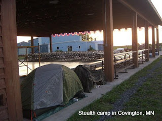
Found a stealth camp under the Covington Event Center’s outdoor pavilion (N46 32.646’ W88 33.459’) at 7:30pm and hung out, reading my new book until about 8:30pm to make sure nothing was happening there, that evening. I then set up my tent, and continued reading until 9pm, eating trailmix and drinking Gatorade. There were mosquitoes, but I set up and was inside before they came out. With no disturbances, and being well away from the road with its noisy vehicles, I had a nice sleep.

Tuesday, August 25, 2009

Day One Hundred Seventy-eight, 090824 - Munising, MI

Day One Hundred Seventy-eight, Date Tuesday, August 25, 2009
Time in Saddle: 3:30
Distance for the Day: 30.14 miles From Munising To Skandia, MI
Accumulated Trip Distance: 8608.3
Altitudes: Starting/Ending 671’/1071’, Highest: 1079’ Accumulated: 1348’
Speeds: Avg: 8.6 mph, Max: 24.0 mph
Weather: 64° clear and breezy, becoming rainy by mid-afternoon
Expenditures: $17

At about 5:20am, I woke up to the sound of a bunch of sprinklers going on. Worried that they were going to start up in my section of the lawn in front of the war memorial, I got up and checked the scene out. As it turned out, it was the lawn just on the other side of the trees where I was – so I missed getting hit by the sprinklers on the lawn in front of the war memorial by mere feet! I really lucked out on that one. It was still dark out, and mostly clear; I saw the winter constellations Orion and Gemini the Twins rising in the east, and the bright star Capella in the constellation Auriga, and was reminded that the cold and rainy season was approaching all too fast for my comfort. This morning, though, everything was mostly dry – no spiders or slugs – I did get hit on the thigh by one mosquito, but it was windy enough that it kept them off me. I went back to sleep for an hour more, before waking up at 6:15am and being ready to roll by 7am.

I went over to the Falling Rock Café and Bookstore to get breakfast (an egg and sausage muffin + hot cocoa) and later, a snack (choco malted and muffin) ($17 total). I also ate the other half of my Subway sandwich. They had free wi-fi, and I used it to catch up nine backlogged blogs, which only took about 9 hours – 7am to 4pm! Today was a good day to do blogging, as it was cloudy and a little rainy – correction, it downpoured just as I was writing this – outside all day. As mentioned, I left the café at 4pm and continued up the road. The rain tapered off and quit altogether, and as the rest of the day wore on, the sky mostly cleared, and the roads dried off. I rode until nearly sunset, about 8pm, before turning off of Hwy 94 to investigate a nice paved road on the left. It went a few hundred yards past a ranch into a forested area, and I found a nice, well-maintained dirt road into the forest. It went for quite a ways, and was some kind of interpretive exhibit for forestry management, complete with signs that explained how to evaluate optimal tree density for eventual harvest. (N46 20.289’ W87 9.304’) I stopped off to the side of the road and found a couple of thin trees to hang my hammock from. This turned out to be a practical, if annoying, lesson in the conservation of energy. The legions of mosquitoes added a desperate quality to the exercise. At first, as I said, I used two skinny trees to hang my hammock, but when I put my weight on it, they bent, putting the hammock almost on the ground, amongst the ferns (aka, slug stairways). Okay, I then hung the hammock higher on the two skinny trees, but when I put my weight on it, again, I found that higher up, the trees would bend more, and once again put the hammock into the ferns. I then put one side of the hammock onto a bigger tree, but that just made the one skinny tree bend more, putting the hammock in the ferns. Finally, I put both sides onto thicker trees, and that put the hammock high enough off the ground. To escape the *legions* of mosquitoes, I had to walk away from the hammock, windmill my arms, and slap my clothes to get them off and away from me, then run over to my hammock, unzip the mosquito netting, get in, and zip it up, quick. I wound up getting one bite that whole time before getting into my hammock, and I didn’t bring any of them with me, inside (a miracle!) Just as I was settling in, I heard some crunching of gravel coming toward me. Hmmm, bears? Then, a man and woman turned the corner of the road, who were sort of speed walking. I called out, “Good evening,” from my hammock, and they stopped, a bit startled, and noticed the “Pod Person” (me) hanging between the trees. They stopped to chat a bit, got interested in my story, and invited me to coffee in the morning. They said they were the first house on the left up the road. Fine business. The temperature was cool-to-cold, about in the mid-40s, but there were still dozens of skeeters swarming my hammock, inches from my face, though they couldn’t get me (heh, heh!) As the night cooled further, they lost interest and went away. The night sky was now clear, and the bright stars shone through the canopy of the forest roof spread out above me – always a pretty sight to fall asleep to.

Day One Hundred Seventy-six, 090823 - Strongs, MI

Day One Hundred Seventy-six, Date Sunday, August 23, 2009
Time in Saddle: 5:59
Distance for the Day: 55.66 miles From Sault Ste Marie To Strongs, MI
Accumulated Trip Distance: 8496.2 miles
Altitudes: Starting/Ending 721’/949’ Highest: 1011’ Accumulated: 1056’
Speeds: Avg: 9.3 mph, Max: 23.7 mph
Weather: 56° partly cloudy, heavier in the east
Expenditures: $29C

I woke up at 6am and got up at 6:10am; still lots of mosquitoes, but conditions were dry, which is always welcome. I had a pretty heavy slug attack this morning, which I had to spend a bit of time dealing with – getting them off my tent and ground tarp. This morning, I woke up with the Joan Baez song, Silent Running going through my head. I rode to the overpass where the highway exit was to get away from mosquitoes, changed my crotch cloth, ate the other banana, and drank a grapefruit drink. I finished packing my bags and continued forward at 7:42am to SSM, which I made by 8:30am. I still had some Canadian money left, so I went looking for someplace I could get breakfast, and charge my notebook and camera, but after going through downtown (everything was still closed), and chatted for a while with an old guy on a bicycle. I looked in the local casino for breakfast/electricity opportunities, but they didn’t allow computers inside – wonder why). I finally found a nice café; they didn’t have electricity, but I went ahead and had a nice $14C breakfast anyways. I then stopped at the duty free store to buy some trailmix and a candy bar, and gave the rest of my change to fight MS.

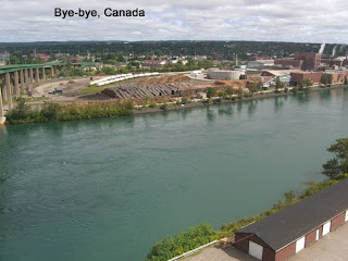
Surprisingly, I was able to cross the bridge on my trike, but this time, I waited in line with the rest of the cars, though this line was much shorter than the one at the Rainbow Bridge in Niagara Falls. I got through customs without incident, and re-entered the USA at 12:35pm. I then proceeded to the visitor center, found an outside outlet, and recharged my notebook and camera, while figuring out how to reorganize and re-synch my iPod. Around 2:25pm, I left to continue on my route, now towards the northernmost point in the contiguous 48 United States: the Northwest Angle. At 6:22pm I was heading west on Hwy 28 out of Brimley, and I have to say: it was just gorgeous! The weather was cool, the breezes were light, the clouds went completely away, the lightly trafficked road with clean, smooth, and sufficiently wide shoulders went through a pretty, low-forest area, and, the climbs were gentle. I went from 750’ to 1K’ but didn’t even notice it, and there were stealth camp opportunities practically every couple of miles. It was like heaven compared to Canada’s Hwy 17 – how nice!

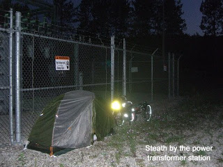
I found a stealth camp site next to a power transformer station a few miles past Strongs Corner at 7:52pm (N46 20.751’ W85 1.111’). It was still pretty bright out, but it was getting kind of cool, so I set up camp and got nailed by three mosquitoes, twice on hands on once on thigh. I was still somewhat visible from the road, but I was at least 60 yards from the road, so I doubt anyone noticed me. Since I didn’t have a book, I listened to my iPod until 12:30am (that thing can be addictive, sometimes) and went to sleep in the glare of the high pressure sodium vapor light, which I didn’t realize was there. Oh, well – I slept undisturbed the whole night, anyways.


___________________________________________________________
Day One Hundred Seventy-seven, Date Monday, August 24, 2009
Time in Saddle: 8:06
Distance for the Day: 81.96 miles From Strongs To Munising, MI
Accumulated Trip Distance: 8578.2
Altitudes: Starting/Ending 949’/671’, Highest: 957’ Accumulated: 1572’
Speeds: Avg: 10.1 mph, Max: 39.6 mph
Weather: 46° clear with lots of moisture on the ground
Expenditures: $20
(Note: I had to append this day's blog to the Day 176 entry as I forgot to post it when I was supposed to. Thanks, M, for catching that!)

Woke up a little late today, stayed up until 12:30am listening to two-out-of-three LOTR albums and others; woke up at 6:08am; still lots of mosquitoes despite the cool temps; put on anti-skeeter gear; attack of the daddy long legs today, and one slug left from yesterday – got rid of them all; the power station had a big halogen light; would have liked to see the stars – haven’t seen them in a while, maybe tomorrow; took off at 6:59am and ready to roll in the Hiawatha Nat’l Forest; 9:39am seen two large birds of prey and a beautiful *live* green racer snake 8” long and a ¼” thick that was sunning on the road, and he raced off into the grass as I went by; stopped in Newbury from 10:15am to 10:40am to get breakfast of cinnamon bun and choco drink and supplies for $12 and cont on towards next target town of Munising; made Munising at approx 6pm and found a Subway so got meal deal, charged up notebook and iPod, and wrote up notes for blogs until 9pm. After spending between 6pm and 9:56pm at Subway charging the notebook and iPod and transferring more music from computer to the iPod, blog writeups for almost 4 hours, left Subway, dark out, small town of Munising which is on one of the great lakes, headed towards the lake and found a very nice spot, grassy area next to a war memorial (N46 24.707’ W86 39.031’), bit windy, kept the mosquitoes off me, away from the traffic, was set up an in tent by 10:30pm, just went right to sleep; at about 2am, I started to see flashes of lightning and heard thunder; got up to make my trike more waterproof; but the storm had passed to the northeast, so I took pictures of lightning over the lake; then went back to bed.

Day One Hundred Seventy-five, 090822 - Sault Ste Marie

Day One Hundred Seventy-five, Date Saturday, August 22, 2009
Time in Saddle: 10:52
Distance for the Day: 100.65 miles From Spanish To Sault Ste Marie
Accumulated Trip Distance: 8440.6 miles
Altitudes: Starting/Ending 1007’/721’, Highest: 1014’ Accumulated: 2293’
Speeds: Avg: 9.2 mph, Max: 28.0 mph
Weather: 53° overcast but dry
Expenditures: $9C

I woke up at 5:35am and broke down and ready to roll by 6:25am. Last night, the traffic noise didn’t bother me, but the barking dog did wake me up about 4 or 5 times (bad dog!) The mosquitoes here were pretty bad, and this morning, they hit my hands a couple of times, Demitol. I stopped at a visitor park about deer trails several miles down the road, and left my Ludlum book there with a sticker in it listing my blog site. I then stopped at 9:30am – 10:08am at Subway and got choco milk and cookies ($4C), and went to the mini mart next door and got $10C of grapefruit drink, nuts and M&Ms to make trailmix, since they didn’t have the kind I liked. I stopped at 12pm in the town of Iron Bridge to get an apple, and orange and two bananas ($5C), and ate the orange and one of the bananas right there. That curbed my appetite, so I planned to eat the other half of my Subway sandwich later. It wasn’t raining, and some patches of blue sky were showing, but not the *clear* blue skies that were promised – poop! At 4:27pm, I stopped for a choco milkshake in the town of Bruce Mines ($4C). It was still overcast, and seemed it could rain, but hadn’t. The sky was even darker up ahead, but the temps were cool and clouds kept the UV off me, which made for pleasant enough riding conditions. It would have been a boring travel day, except I had to keep constant vigil for upcoming big rigs both fore and aft to be able to ride off into the gravel whenever they converged with me (ugh!) These convergences happened every now and then, which kept me on my toes. The terrain was still mostly level with some minor hills. There was one quarter-mile stretch of road where along its length, I saw about a dozen columns of swarming insects – haven’t really seen this phenomenon, before, and after that one stretch, I didn’t see any others – odd.
At about 5pm, the overcast finally broke up enough to let the sun through; it was still cloudy up ahead, to the west, but overhead it was mostly clear, with some cumulous puffies. At 6:17pm, about 25 miles east of Sault Ste. Marie (SSM), Hwy 17 became a much nicer split highway with two sets of lanes going each direction, separated by a wide divide. The road shoulder was still too small for my trike, but it was smooth, and lightly traveled, so no one had any trouble getting around me. The sunscreen I made for my helmet worked great, and saved me from a lot of pain. I got “used” to Canada’s highway configuration, and could successfully and comfortably ride it, as long as I stayed constantly vigilant for large vehicle convergences. In trying to make SSM today, I pushed and made my fourth century (100 miles) for the trip at 8:25pm, about 5 miles shy, so I essentially did make it (yippee!) The last glow of pink was in the clouds in the west, and right after I made the century, I took an exit almost immediately to find a suitable stealth camp on a gravel road that paralleled the highway (N46 32.694’ W84 7.998’). Of course, there were lots of mosquitoes, so I had to immediately implement anti-skeeter measures. When I dove into my tent, two of ‘em made it in with me, so I made sure to kill ‘em. I think that was the first century I’ve done without going past sunset – good for me!

Day One Hundred Seventy-four, 090821 - Spanish, Ont

Day One Hundred Seventy-four, Date Friday, August 21, 2009
Time in Saddle: 7:27
Distance for the Day: 67.15 miles From Little Current To Spanish, Ont
Accumulated Trip Distance: 8339.9 miles
Altitudes: Starting/Ending 878’/1007’, Highest: 1156’ Accumulated: 2339’
Speeds: Avg: 9.0 mph, Max: 36.4 mph
Weather: mostly clear 63° becoming cloudy with occasional showers
Expenditures: $18C

I didn’t seem to notice any yesterday evening, but this morning, there were inch-long mosquitoes buzzing about, though they weren’t very aggressive. I got up at 5:22am, took pictures of predawn skies, and broke down and was ready to roll by 6:22am. I crossed the swinging, wooden road bridge after Little Current at 6:38am. The wood that made the floor of the bridge had smooth ruts worn into it from cars passing over it. I stopped to take some pictures of the bridge, the river, and the sunrise. Riding into the sun this morning, I could see lots of single-strands of glistening spider webs stretched between the roadside bushes. I also notice one short segment of the road where masses of flying insects aligned themselves over the white line on the side of the road; why they did that was a mystery. Maybe they weren’t old enough, yet, to cross the road. I stopped from 9am – 9:30am to get breakfast of choco milk, choco cupcake, and mini pecan pie + some drinks ($9) at a mini mart. Then I made a big mistake: I lost one of my somewhat expensive lightweight gloves – that was a definite pisser. They protected my hands from solar UV radiation, were washable, and most of all, they *fit*. I’ll have to try to replace them, but it’s not going to be easy. In the meantime, I’ve still got my heavy gloves, and since the weather is getting generally cooler, anyway, they’ll do fine. The day started out beautiful, with mostly clear skies, cool temps, and easy rolling terrain, but things went “uphill” from there. The terrain became more than “rolling,” but not quite “mountainous.” Plus, the weather turned occasionally nasty, with dark gray clouds, and occasional thunder with brief rain showers.

This day, I was a god – not *the* god, but just the God of Rain. I could control it. Whenever I put my rain suit on, which I did at 10:30am, the rain stopped. When I took it off, the would rain start. Make that, “The Most-Annoyed God of Rain.” Stopped in Espanola, Ontario Canada at 11:30am – 1pm to get a Subway meal deal ($9), and to charge up my notebook and iPod, and to do some blog writeups and transfer pictures to the notebook. That iPod software isn’t very user friendly – I think I lost all my Abba songs (Demitol). Just need to go a little more north on Hwy 6, and then head due west on Hwy 17 in Ontario, Canada. It rained several times throughout the day – once, heavily, with low visibility and rushing big rigs only a few feet away. My glasses were fogged so I couldn’t see very well, and the road had narrowed to almost no shoulder, so I had to put my left wheel on that skimpy shoulder and the other two in the muddy gravel while getting seriously sprayed with water from the passing vehicles. Fun, fun, fun! So much for the “30% chance of rain,” predicted for today – the day before was supposed to be 60%, and it wasn’t nearly as bad. After surviving that for a while, the weather cleared, again, and the terrain remained pleasantly rolling - no big hills – mostly flat. At 6:45pm I looked west and saw some really black clouds up ahead. I saw church up off the road just then, and decided that though it was still a bit early, I didn’t want to make camp in the rain, so checked with neighbor next to the church, and he said it would probably be okay to overnight, there (N46 12.458’ W82 28.686’). The traffic noise was a little loud, even behind the church on the lawn, but not too bad. There were lots of mosquitoes, so I immediately donned my anti-skeeter gear and didn’t get one hit (yay!) I set up and hopped into my tent with grapefruit drink, trail mix, and book (The Bourne Ultimatum), and finished all three. It did rain briefly, but it stopped almost immediately, and I got to sleep around 10:30pm.

Day One Hundred Seventy-three, 090820 - Little Current, Ont

Day One Hundred Seventy-three, Date Thursday, August 20, 2009
Time in Saddle: 6:41
Distance for the Day: 65.89 miles From Lions Head To Little Current, Ont
Accumulated Trip Distance: 8272.8 miles
Altitudes: Starting/Ending 796’/878’, Highest: 1182’ Accumulated: 2375’
Speeds: Avg: 9.8 mph, Max: 29.8 mph
Weather: 58° overcast becoming rain, and then clearing at end of day
Expenditures: $54C

I woke up at 5:45am, got up at 6am, and was (almost) ready to roll by 6:50am. I got hit twice by mosquitoes despite measures, and had to fight off slugs (yech!) The mosquitoes were so bad, I have to escape them before being totally prepared to roll – once away, I finished the usual travel preps, and then really got underway. I should hit Tobermory today, and take a ferry across Lake Huron towards Espanola. A miracle occurred, today: I met Angel Lucy and her cycling partner, Barbara! (See Day Twenty-eight.) Lucy was the wonderful lady who gave me, Cati and Eusebio sanctuary back near the end of March in Hurricane, UT. She’d said, then, that she was going on a cross-country cycling trip, and by golly, she wasn’t kidding. With sweat on her brow, and legs that looked like they belonged on an athlete rather than a white-haired LOL (Little Old Lady), we hugged and then chatted for about 15 minutes, comparing a bit about our respective trips. She started in Washington state, and made it to Northern Lake Huron, on her way to Portland, Maine. Then we took pictures, and each continued on our respective ways. It was absolutely *amazing* that we should meet like we did, on the road – a real trip highlight, fer shure!
I made it into Tobermory at 10am, and immediately bought the ticket for the ferry ($26C), before going over to the nearby restaurant for a quick breakfast ($15C) while waiting for the 11am departure. I met Harry and Freedom who passed by as I was waiting to board. They were very interested in my story, so we chatted, and I took their picture by my trike. After the ferry came in to dock, they took about 20 more minutes to unload before we could board. We then we took off at 11:25am for S. Baymouth, about 27 miles to the NW across the waters between Lake Huron and Georgian Bay. It was a big boat, with restaurant, gift shop, lounges, and three outside levels. I wandered around the whole ship, taking pictures and chatting with some of the other passengers. We arrived at our destination on Manitoulin Island at 1:20pm (a little less than a 2-hour trip), and began heading north, still on Hwy 6. The weather was still overcast, but light enough that infra-red heat could come through; it could rain, later, but was okay for now.

At one point, I stopped to take a picture of my trike coming up the road through a cut in a hill with dramatic clouds in the background. As soon as I finished taking that picture, it started to rain, hard. I put on my full rain gear, including “plastic socks” (Subway bags); and a few minutes later, the rain stopped. I pulled into a combination mini mart/hardware store, to get some liquids and a butane refill canister for my lighter ($9), and while I was in the store, it really came down cats and dogs, which was fine by me. I drank my soda under the covered patio area of the store, and waited for the rain to let up, which it did in a few minutes. I then, continued north on Rte 6, stopping to got a few more drinks and food items along the way ($4C).

By late afternoon, I arrived in the town of Little Current, and found a possible stealth camp below their visitor center, down a steep path to a concrete pier on the water. I verified with the people at the center that there were no specific rules against overnight camping, so at 7:15pm I rode down to the pier, and ready my book and talked to some ladies who were fishing on the next pier. They caught 5 fish, already, and I saw one lady catch a goby – a nasty, invasive species, so they killed it and threw it back in. We chatted a bit, and one of the ladies picked some “choke cherries” off some nearby bushes for me – small, round, red or dark red berries that were edible. They had the interesting property of drying out your mouth, even though they were juicy – hence the name. They probably had a high tannic acid content, or something like that. A little later, a couple of young boys came down on their bikes near sunset and hopped into the water to swim; it was a bit cool for me, but they didn’t seem to mind. They asked about my trike, and we chatted a bit – I could see from their legs that they got lots of mosquito bites, but seemed to just accepted them as a way of life. The water was very clear – I could see through about 20’ of water to the bottom, and wished I had my snorkeling gear with me. I continued to read my book and waited until it got almost dark at 8:30pm before setting up my tent on the dock (N45 58.763’ W81 55.007’). I briefly wondered if some evil person might push me in my tent into the water, but figured I could still get out alive, and hopped in, anyways. I got to sleep about 10:15pm.

Day One Hundred Seventy-two, 090819 - Lions Head, Ont

Day One Hundred Seventy-two, Date Wednesday, August 19, 2009
Time in Saddle: 8:14
Distance for the Day: 81.55 miles From Durham To Lions Head, Ont
Accumulated Trip Distance: 8206.9 miles
Altitudes: Starting/Ending 1339’/796’, Highest: 1391’ Accumulated: 1791’
Speeds: Avg: 9.9 mph, Max: 31.2 mph
Weather: 62° clear and dry, warming to low 70s
Expenditures: $16C

It was nice and quiet back behind the church, but some knucklehead down in the park behind the church yelled about 4 times at about 3:45am, and then at 4:30am, I heard what was probably a dog-walker go “oh!” (they must have been surprised at coming upon me back there) and heard a dog come snuffling at my tent, but experienced no further intrusions after that. I got up at 5:30am, and was broke down and ready to roll at 6:10am. The sky was clear, the air was dry, and I could see Venus in the growing light of day. The bats were flying all over and even around me, and the bees are going into a small hole between some bricks at about 10” from ground level – neat! I took off, but then stopped at 7:45am for a breakfast of hot cocoa, scone and date bar at a small restaurant ($4C), before continuing on at 8:26am north on Hwy 6.
Oops! I took a wrong turn from Wiarton 6-miles to a touristy resort town called Sauble Beach, but I at least got my first look at Lake Huron; I don’t think I’ve ever seen a lake where you couldn’t see the other side, before. Since I was there anyways, I stopped for lunch ($12C), and charged up the notebook, camera, and did some blog writeups. I left at 2:12pm back to Wiarton to pick up my route, again. The weather was predicted to rain for the next several days, but for the time being, it was beautiful. Brought out my iPod to specifically begin learning Joni Mitchell’s “The Circle Game” song. It took about a half the day to get the lyrics mostly right, and then another half day to get most of the nuances and timings down. An amazingly true, touching, and somewhat difficult song to learn – at first, I had trouble not choking up from the emotional content behind the lyrics and music (I must be getting sentimental in my old age). I found that evening’s stealth camp at 7:30pm; a Canadian Legion clubhouse with nice lawn in back (N45 00.379’ W81 18.357’), but it had tons of mosquitoes and slugs (yech!) The weather was still clear and temperate, though later that night, I was awakened by one flash of lightning and thunder about two miles distant, and got a little rain – not too bad.