Monday, April 27, 2009

Day Fifty-three, 090422 - Ft. Davis, TX

Day Fifty-three, Date Wednesday, April 22, 2009
Time in Saddle: 7:45
Distance for the Day: 72.61 miles (still in Ft. Stockton, TX)
Accumulated Trip Distance: 2326.5 miles
Altitudes: Starting/Ending 3277’/3194’, Highest: ??, Accumulated: ??
Speeds: Avg: 9.3 mph, Max: 20.3 mph
Weather: balmy/mostly clear, becoming very warm and overcast
Expenditures: $54
Went to Ft. Davis to attend a few days of the Texas Star Party, and forgot to record my end of day altimeter stats, so the Highest and Accumulated stats are now unknown.

Woke up at 6:30am, about 30 minutes before sunrise, with a few stars still in the sky. Perfect! Packed up quick like a bunny, and got out of the church’s back alley without being spotted. I took a leisurely ride back into town, to find the donut shop where I could hopefully have a donut and continue work on the blog (I did, and I did). Got a couple of donuts, a hot coco, and a couple of jalapeno “pigs in blanket” (wieners baked into pastry) ($9). Yummy! Bill was going to show up in town sometime before noon to pick me up, to take me to the Texas Star Party location (near Ft. Davis, almost 100 miles from Ft. Stockton!), so I went back to the library at 9am to upload the blogs to the site. Bill and I exchanged a few more text messages and phone calls to arrange a pickup time and place, and I finished processing blog entries and uploading them until he arrived. This was really nice of Bill, driving nearly 400 miles for two round trips to come get me so I could attend the TSP for a day or two, and then bring me back, and I am very grateful to him for doing that. We stopped in at the market in Ft. Davis at about 2pm to get some supplies ($4), and then we continued on to the Prude Ranch, which hosted the Texas Star Party. I got the $0.25 tour of the site, which had two large, flat grass-and-dirt fields where more than a hundred telescopes of every type and size were set up. They had an indoor swimming pool (I could water-test my leaky air mattress there, yay!), a large dining room building, horse corrals with a few horses in them, a ham radio shack, several sets of bunkhouses with bathrooms and showers, areas for RV and tent camping, a building for a few vendors selling t-shirts, equipment, artwork and jewelry, and other amenities. Most importantly: free wi-fi! As you might have guessed by now, the best place for me to work was - in the bathroom. It had electricity, it was quiet most of the time, and I could work there without disturbing anyone. I paid the registration fee which included meals and a bunkbed. Ahhh, a real bed! I tested my mattress in the pool and found the third puncture; a tiny little thing that didn’t even show unless I put pressure on the mattress to force the air out of the puncture. I set the mattress up outside my bunkhouse to dry, and then went to have a very nice dinner of roast beef, sausage, beans, corn on the cob, rolls, salad, and apple pie and/or peach cobbler (I had both). The weather the previous three nights was clear and very cold, but this evening it was balmy and clouded, so there was no observing going on. We chatted with other attendees, most of whom Bill knew from previous years, and then went to listen to the evening’s speaker, Dr. Fritz Benedict, who spoke on the subject of extrasolar planet finding using the nearby McDonald Observatory's HET telescope - very interesting. His laser pointer died on him, so I let him use my 35mw green LP, and it caused quite a bit of amused “shock and awe” in the audience each time he used it, it being a bit too bright for normal presentation purposes. Each time he used it, he commented on how dangerous it was :-) We eventually went to the snack commissary to get some hot coco, and chatted with the guys who were running the commissary: Bill and his son, Oscar. We came back to our respective bunkhouses sometime after midnight, to get sleep, but I, of course, stayed up until 3am doing blog stuff, before hitting the hay.

Wednesday, April 22, 2009

Day Fifty-two, 090421 - Ft. Stockton, TX

Day Fifty-two, Date Tuesday, April 21, 2009
Time in Saddle: 5:59
Distance for the Day: 58.91 miles: From Pecos, TX To Ft. Stockton, TX
Accumulated Trip Distance: 2312.8 miles
Altitudes: Starting/Ending 2846’/3277’, Highest: 3355’, Accumulated: 1007’
Speeds: Avg: 9.8 mph, Max: 20.3 mph
Weather: 45° in the AM, warming to upper-80s, low 90s in the afternoon
Expenditures: $33

The Thermarest mattress held its air better, this time, but it still seemed a little bit deflated. Demitol! It probably still has a tiny leak that will require a full-submersion water test to find. Swimming pool, anyone? I got up just as the sun was rising, right at about 6am, and packed up. I actually went back into town to pick up a few needed items (a new lighter, another spare inner-tube, a 2GB SD card, and some marker pens) ($30), and then headed out of town SE on Hwy 285, heading for Ft. Stockton. It was hotter, today, and I found it harder to get and keep up my speed. About 25 miles out of Pecos, I met this black guy, Jimmy, walking through that west Texas no-man’s land with a Stetson hat and a plastic bag with some clothes in it. He was trying to hitchhike, but no one was picking him up. I gave him a quart of Gatorade, an apple, and a big candy bar. Sure hope he was able to finally get a ride – I don’t know how he decided to try to walk anywhere in that heat without supplies, but it wasn’t a wise thing to attempt.

I watched the rest of Star Wars Ep. VII: The Empire Strikes Back, and then started Ep. VIII: Return of the Jedi. The miles crawled by in the heat; my knees were hurting again, so I had to slow down. I finished the movie, and decided to try listening to music for the first time from my CC Witness radio/mp3/recorder combo device, and it helped keep my mind off all the pain and suffering I was going through. I finally limped in to Ft. Stockton by about 3:30pm. Bill D and I had been trying to contact each other, because he was attending the practically-nearby Texas Star Party at Ft. Davis, about 80 miles to the southwest of Ft. Stockton. He offered to come pick me up and drive me up to it so I could attend for a night, and I agreed (thanks, Bill!) I went to the town library and accessed the free wi-fi, worked on the blog, and left at closing time. Then, I went to the town park, and cooked up some rice and brussel sprouts for dinner, and went into the downtown to get a Dairy Queen choco malt ($3). Unfortunately, this one wasn’t as chocolaty or malty as the one in Pecos, but I still enjoyed it. I went back to the library and found a power outlet nearby – I could work on the blog, but their wi-fi was shut down. A local in a truck stopped by out of curiosity to see what I was doing, and we chatted about my trip and the Marfa lights that were apparently an attraction of sorts someplace near the region. I worked until 11:45pm, and went to find a stealth campsite somewhere nearby.

This turned out to be a challenge; there were streets with houses, some of which had noisy dogs. I went back to the main strip, but didn’t find anything there. I remember seeing a couple of churches at the end of the town’s historic Main St., so started heading that way, when a cop car drove up and asked what the heck I was doing wandering around at midnight in a recumbent trike. I told the officer that I was looking for the Catholic church on Main St. to possibly steal… to camp, there, and he obligingly gave me directions (I almost said “stealth”). I found the church, didn’t see any sign that anyone was still up, and moved my trike behind it in a clean little alleyway between buildings. It was still shirt-sleeve weather, so I just put out my tarp, air mattress, and sleeping bag, and hit the hay at 1:40am. I would wake up early, and get out before anyone would notice. Yeehaw!

Day Fifty-one, 090420 - Pecos, TX

Day Fifty-one, Date Monday, April 20, 2009
Time in Saddle: 9:50
Distance for the Day: 95.82 miles: From NE of Whites City To Pecos, TX
Accumulated Trip Distance: 2253.9 miles
Altitudes: Starting/Ending 3778’/2846’, Highest: 3788’, Accumulated: 1102’
Speeds: Avg: 9.7 mph, Max: 23.4 mph
Weather: 48° in the AM, warming to the mid-80s, clear with light breezes
Expenditures: $33


Got up about 5:45am, finished breaking down by 6am (sunrise), had a bit of breakfast, and was ready to hit the road towards the town of Carlsbad, NM by 6:45am. Slight change of plan: at 7:18am, decided to skip going to Carlsbad by taking County Road 720, which cuts out the corner that Carlsbad is in, and leads to Hwy 285, making it a mere 85 miles to Pecos, and whacking a good 30 miles off the route. I didn’t really need to go to Carlsbad, anyways – nothing there I couldn’t get at Pecos, TX, so, fergeddit. I made one little error, though: I don’t think I quite brought enough to drink for the trip, and every “town” along the way had no services. Of course, there were always some residences, where I’m sure I could have begged for water, but I didn’t want to have to do that. I got what I believe was Flat Number Nine at 2184.0, and had it “fixed” by 10:07am. A previous patch had failed, so I just pushed it back down to re-seal it (may or may not work). I used one of my compressed gas cartridges to overinflate it, to bring out the tire’s bead. (The beads on Schwalbe tires are apparently a known problem. They’re good tires, but you have to take extra measures to get them to fit right.) I entered Texas and Mountain Time, again, at 11:22am. I saw a roadrunner for the first time in the wild, he was about 50 yards ahead of me; he dashed out into the middle of the street, and then dashed back into the bushes. Meep-meep! My starboard front tire went flat again about 12:11pm – the patch failed again, so this time I just replaced the tube with a new one.

When I arrived at about the halfway point, the “town-that-used-to-exist-but-didn’t-any-longer,” Orla, was like a mini-ghost town, with old, decrepit gas station, store, and other small buildings, except for one bright red roof sitting a bit behind the rest. I was skeptical, but went to take a look anyways. By golly, it was the Red Roof CafĂ© and Bar, and it was open! I went in and got a soda + two pints of water ($3) (enough to get me safely to Pecos), and chatted with the two nice ladies, there. I suggested they put a sign out on the highway advertising their presence, and they said they had something in the works. We chatted about my trip, and they wanted to give me more water and food for free to help the cause. I thanked them, but only took one more bottle of Clamato Tomato Cocktail, more to make them feel good than out of any actual need I had. They were so nice! Fully re-hydrated, I continued on down the road. The sky was totally clear, and the sun was hot, even though the air was only warm. By the time I hit Pecos, it was mid-to-late afternoon, and I stopped in at the local firehouse to ask where in town I might find free wi-fi. The only place the firelady knew about was a Mexican restaurant further on in town. I headed out that way, found the restaurant, but didn’t want to spend the money to buy a meal and to use the wi-fi. There was a gas station across the street, so I went over there and did something else: I water tested my leaky Thermarest mattress. I just took my bottles of water and poured it over the bottom side, and sure enough – bubbles from a spot that showed no indication of a puncture. I circled the spot with a pen, and then spent the next 15 minutes drying the mattress by waving it around in the warm, dry air. I must have looked kind of like a kook, dressed in my biking tights and helmet, waving this big orange thing around for no apparent good reason. Oh, well. I got it dry, and put another inner-tube patch on it; hope it works!


I went back across the street to the restaurant, and sat outside on the curb, and hooked-in to the wi-fi, and worked there until it was dark. Embarrassingly, the owner of the restaurant came out after it closed, and asked if I was “stealing secrets” from his network. I felt about *this* small, but replied in the negative. I finished up, and wondered what I should do about camping, when I saw the Dairy Queen was still open. I went in and got a burger and choco malt ($6) – mmm-mm! That choco malt was great! Okay, now what? I went to the grocery store and bought some fruits and vegetables ($4) out of guilt for having that burger, and then went looking for a campsite. I was headed out of town, when I saw a Flying J truckers’ stop, and went in there to look for some trail mix. I found out they also had hot showers, and a Laundromat. I was filthy, and two whole sets of biking clothes (that included the one I was wearing) were dirty, and I decided to come clean. I had been hand-washing my clothes in sinks, but I figured at least once in a while, I should get everything *really* clean. So I paid for the shower ($8.50) and the laundry ($4 for washer, dryer and soap), and more food supplies ($9) and took a long and luxurious shower, got *all* my clothes clean, and even worked on blog material – how nice! By the time I was done, it was almost 2am, I started packing everything back on the trike to go, and got to chatting with one of the truckers. He was impressed with my story, and wanted to give me money (I told him I was laid off), but I thanked him, and told him I wasn’t poor, just out of work. Another example of how kind and generous people can be. Okay, so it was dark, I was heading down a dark highway in the wee hours, and found a side road which I followed a few hundred yards from the main road, and stealth camped there. It worked out well – that road wasn’t used at all during the night, and only started to get occasional and sporadic traffic just before sunrise, so I had a good, if somewhat short, night’s sleep.

Day Fifty, 090419 - Whites City, TX

Day Fifty, Date Sunday, April 19, 2009
Time in Saddle: 2:58
Distance for the Day: 21.97 miles: From West of Whites City, NM To just NE of Whites City
Accumulated Trip Distance: 2158.1 miles
Altitudes: Starting/Ending 3790’/3778’, Highest: 4138’, Accumulated: 879’
Speeds: Avg: 7.3 mph, Max: 35.3 mph
Weather: 44° in the AM, warming to temperate levels during the day, clear
Expenditures: $35

Woke up just before sunrise, packed up quick, had a PayDay candy bar for breakfast (I’d have a bigger one in Whites City), and headed for the main (paved) road to attempt resetting my derailleur. I fiddled with it for about 45 minutes, and got it to where it seemed to be working okay. I then rode into town, found out from the Info Desk, there, what the deal was with how and when to see the Caverns, and went to have a real breakfast at the local restaurant. Ham & eggs w/toast and OJ – mmm-mm! ($9) Okay, it was seven miles up the road to the caves, so I started. I got the unpleasant surprise that it really was UP the, at times, pretty steep road, so my progress was slow, and my gears started to slip again. Arghhh! I hobbled along, and pulled off at a level spot to continue fiddling. Fiddle, fiddle, fiddle, for another 20 minutes. Twist this knob, loosen and retighten this cable a couple of times. This time, I got it right – everything worked perfect (yay!) So, I continued up, slowly but Shirley, and finally got to the Carlsbad Caverns National Park at the top of a small mountain. I found the loading bay door, found it unlocked, and went in to find someone I could talk to about possibly storing my trike while I did my visit. “This is an employee-only section, sir; please go back out and come around to the Information Desk.” Thanksalot – most helpful. At the desk: “Sorry, sir, but public can’t leave things in or attached to federal buildings.” Thanksalot – most helpful. Okay, Plan B: put most of the valuables into my tiny backpack (computer, helmet cam, backup disk drive), lock the trike up out front, and cover the panniers with my stealth cloth. I’ve done this before at other high-traffic places, and so far, it’s worked (knock on wood).

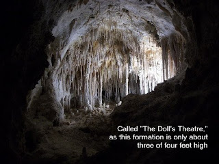
Since I have the National Parks Annual Pass, the entry was free (yay!), and I only did the self-guided tour (without the wireless speaker thingy). They have an $8 guided tour of another, smaller section of the cave, but I didn’t do that. I just walked through 75% of the publicly accessible underground complex of caves with my jaw dragging along behind me about three feet. I mean, literally, my mouth was agape most of the time I was down there. The entryway was this humongous hole the size of the Super Dome tipped on end, with a very nice and evenly paved walkway with handrails leading down a series of zig-zags down, down, down hundreds of feet. The mildly unpleasant smell of bat guano was present, but not overpowering, and disappeared in a few minutes. I won’t go into detailed descriptions, other than to say the vastness of this sub-surface world was strange, beautiful, and always mind-boggling in its scope and diversity. I would have liked to do some 3D pictures, but in the low lighting, it just wasn’t possible. After about three hours, I resurfaced up the seven-story high elevator through solid rock back to the surface. I perused the gift shops, and got a burger, ice cream sandwich, and soda for lunch ($10). After that, I went back to my trike, answered questions of curious passer-bys, and took off back down that road, stopping every now and then to read interpretive stations explaining the terrain, history, culture, and plants of the region; all very fun and educational.
I got back down into Whites City, bought a quarter-pound of choco fudge, some groceries ($16) and settled in the hotel lobby with free wi-fi to catch up on some email and do some blog entries. By the time I was done, it was dark out, and I had no idea where I was going to camp. In these situations, I am prepared to accept stealth sites of lesser quality, and found one quickly enough just down the road about a half-mile, in a field behind an abandoned gas station. Still pretty close to the road, with traffic noise, but in this remote location, there wasn’t that much traffic, and I’ve always got those earplugs. I set out my gear, hoping I wasn’t setting up on a bed of thorns or nest of black widow spiders, and went to sleep, counting satellites (found 9 of ‘em!) at about 9pm.

Day Forty-nine, 090418 - Whites City, TX

Day Forty-nine, Date Saturday, April 18, 2009
Time in Saddle: 6:50
Distance for the Day: 62.49 miles: From Stealth Camp To just west of Whites City, NM
Accumulated Trip Distance: 2136.1 miles
Altitudes: Starting/Ending 4116’/3790’, Highest: 5764’, Accumulated: 3812’
Speeds: Avg: 9.1 mph, Max: 40.9 mph
Weather: Clear, cool, calm, warming to temperate conditions during the day
Expenditures: $0

No pictures today: sorry! Mattress was flat again, I looked high and low for the leak, but couldn’t find it. I’ll definitely have to give it a water test, Demitol. At 8:08 am I hit the road, continuing on to Carlsbad Caverns, which I should just about reach, today. Not much happened, today, except…

At 4:40 pm, I almost had a big accident: while coming downhill at a good 15 mph, to avoid a highway sign on the shoulder, I had to ride onto a highway buzz strip (those indentations that cause car tires to “buzz” when they drift off the main road). Hitting the strip caused my trike to drift, and to keep from getting turned sideways and flipping, I had to steer into the drift, which took me off the pavement, and into a v-shaped dirt ditch, still going a good 10-15 mph. I rode this dirt ditch, going up one side, and then the other, until I managed to finally slow down and stop. Due to the rough conditions, the pack on top of the rear rack fell off, one of the support struts for the rear fender broke, and the front and back main body segments got twisted from their true position, slightly. Nothing serious, but a pain, to be sure. There wasn’t much I could do about the broken strut, but it wasn’t a critical part, and wouldn’t cause problems. I re-aligned the front/back body segments, so they were okay, but now the rear derailleur was slightly “off,” and gear changes were hesitant and glitchy. Poop. I figured the cable from the control at the handlebar needed adjustment, but I’m no pro at that, and fiddled with it as best I could, but only got it to work a little better. I’d have to call my dealer, Steve, first chance I got. This incident happened at trip distance 2128.0 miles. With the tailwind, and the land still mostly downhill, I was close enough to make it within spitting distance of Whites City, the entryway to Carlsbad Caverns before sundown.

I found a stealth camp site off of Dillahunty Rd, called my trike dealer and spent a fair bit of time discussing with him the procedures for fixing the gear shifting problem I was experiencing. I couldn’t do it right then, because I was in an area with fine dust and dirt, and couldn’t take my bags off the trike without getting them very dusty. I got his instructions, and would put them into practice tomorrow morning, when I could get to a cleaner area.

I washed hair and did the sponge bath thing from one quart’s worth of water, had can of soup for dinner and M&M Peanuts for dessert, put out my sleeping gear, and got to sleep. The air was dead calm, now, but around midnight, a brisk but sporadic wind picked up out of nowhere. It woke me up, briefly, but it didn’t keep me up, and I had a good night’s rest.

Day Forty-eight, 090417 - Cornudas, TX

Day Forty-eight, Date Friday, April 17, 2009
Time in Saddle: 8:17
Distance for the Day: 84.77 miles: From El Paso To Cornudas
Accumulated Trip Distance: 2073.6 miles
Altitudes: Starting/Ending 4303’/4116’, Highest: 5559’ Accumulated: 3028’
Speeds: Avg: 10.2 mph, Max: 37.9 mph
Weather: 53° clear, cool in the AM, becoming slightly warmer
Expenditures: $28

Got up late (6:45am after sunrise!), no big surprise, after going without sleep the night before, but nobody discovered me, and so I packed away quick like a bunnie. Unfortunately, my Thermarest mattress was flat, again. The patch on the first puncture seemed to be holding, okay, so I may have another leak, Demitol. Oh, weird thing: as I unzipped my starboard seat pannier to start loading my gear into it, a shiny black spider fell out. I looked inside, and it had started to spin a web inside my pannier. I grabbed one of my sandals and flipped it over to see the red hourglass on its abdomen. Damn! The last time I had that pannier open was in the field behind the airport in Deming. I have no idea where it came from, or how it got in my pannier, but I gave it a quick whack with the sandal – didn’t want to leave a widow next to the church’s tot lot, cleaned out the webbing, finished packing up, and left. I went up the street to a Burger King to get a quickie breakfast ($7), and to consult my StreetAtlas for how I should proceed. I left at about 8am, but still had a little trouble navigating through El Paso getting to northeast bound Hwy 62, but not too much. I got another flat tire at 1993.8 miles while still in the Coronado Hills area, and pulled in at a conveniently close gas station to fix it. As it turns out, I had to replace the inner-tube with one of the two spares I carry. I then continued on at about 10:06 am. I stopped at another gas station mini-mart to get some supplies ($7), and an Ace hardware store to get another spare inner-tube to replace the one I just used ($8). I also got and ate the first half of a footlong Subway sandwich for lunch ($6). While El Paso didn’t seem to have much to commend, I wasn’t accosted by desperate drug dealers or junkies, and indeed, left my trike unattended for ten minutes while getting the inner-tube without having it stolen or robbed. It seemed like just another American city with a heavy Mexican influence (more bi-lingual signage, lots of Mexican food restaurants, etc.). Still, I was glad to find the highway out of town, and get out into the clean, congestion-free regions to the northeast. Had a nice tailwind to push me along, too. I love that.

After leaving town, it became just road and desert; not much to comment on. I whiled the hours away by watching my favorite movies in my head. Today’s selection was, “Joe vs the Volcano,” with Tom Hanks and Melanie Griffith. If you haven’t seen it, yet, see it! And be sure to look for the zig-zag lightning symbology throughout the story. It’s pretty cool.

I hit probably the toughest grade available in all of Texas today: the Guadalupe Mountain pass. It wasn’t really all that high, but it had a rather long, steep segment that really got my attention. I had the other half of my Subway sandwich at a rest stop along the way up, and finished the grade by mid-afternoon with a nice, fairly strong headwind to help slow me down. I hate that.

At around 7:34 pm, when I found a nice side road to get a little bit away from the traffic noise of the highway, to stealth camp (N31° 44.763' W105° 17.062' ). I bedded-down and got to sleep a little after sunset. My Thermarest mattress continues to go flat during the night, indicating a slow leak. Demitol! I’m going to have to do something about it – probably do a water test of some kind (to spot bubbles). Not sure exactly who I’m going to manage that. The stars out there are pretty fantastic, and I found constellations, deep-sky objects, and planets, to help me get to sleep.

Day Forty-seven, 090416 - El Paso, TX

Day Forty-Seven, Date Thursday, April 16, 2009
Time in Saddle: 6:12
Distance for the Day: 51.64 miles: From Las Cruces To El Paso
Accumulated Trip Distance: 1988.8 miles
Altitudes: Starting/Ending 4009’/4303’, Highest: 4431’, Accumulated: 1050’
Speeds: Avg: 8.3 mph, Max: 21.0 mph
Weather: Mostly clear, cool and slightly breezy, becoming pre-frontal, and then clearing and cold Expenditures: $42

I continued working on the blog at Denny’s, had breakfast there, and then left at 7:45 am to finish up at the public library (full signal strength wi-fi, there). All totaled, I spent $25 at Denny’s for dinner, a drink, and breakfast, plus $13 at Chevron for lunch, and other food items for the road. Based on the advice of Debbie D, and others around town, to head for Carlsbad Caverns via the infamous/dreaded, drug-war torn El Paso, rather than through another, tougher, mountain pass to the northeast of Las Cruces. I took a long side road that roughly paralleled Hwy 180. The clouds looked kind of “weird,” and the wind was picking up, so I thought I was going to get rained on. I pulled off to a quiet side road between walnut orchards to take a short nap. A few raindrops fell, so I put on my rain gear, but it never did rain (fooled again). I stopped in at a McDonalds and got a McSalad (or something like that) ($4), and checked the StreetAtlas. When I finally pulled into El Paso in the afternoon, that side road led into the industrial section at the east side of town, and I didn’t see anyplace I’d want to stealth camp in. I backed-up a mile, and took a road leading into a kind of upscale suburb of the region called Coronado Hills – lots of neighborhoods, with a main strip of nice, name-brand businesses, and *churches*. I found one right off the main strip (not so good due to traffic noise, but it was getting dark), and knocked at all the doors. There were cars in the lot, but no one answered. Hmmm, I thought I’d look around more to see if I could find anything else, but keep this one in mind. So, I rode further up the main strip, and found another couple of churches, but one looked like it was having a big event, and the other one already had some kids camping out behind it, and I knew that would be out of the question. I went back to the original church, and the cars were gone. I found one, tiny little corner (out of the wind) with a nice brick surface that I could curl up in, and put out my gear, cloaked the trike, put in my earplugs, and went to sleep immediately. Nothing woke me up, that night.

Thursday, April 16, 2009

Day Forty-six 090415 - Las Cruces, NM

Day Forty-six, Date Wednesday, April 15, 2009
Time in Saddle: 6:06
Distance for the Day: 67.34 miles: From Deming, NM To Las Cruces, NM
Accumulated Trip Distance: 1937.2 miles
Altitudes: Starting/Ending 4392’/4009’, Highest: 4520’, Accumulated: 1257’
Speeds: Avg: 11 mph, Max: 35.2 mph
Weather: 46° partly cloudy, high strato-cumulus, clear to the south, but cloudy to the east
Expenditures: $67

Got up at 5:30am while the sky was *just* getting the first hint of daylight. The stars were still out, and the slightly gibbous waning moon were up when I took my sponge bath and changed my clothes. You know you need to clean up when your spandex pants start sticking to you! Had an apple and trailmix for breakfast before taking off from Deming to Las Cruces, a fairly easy 53 miles away. I would make my Wednesday target date – how nice. Today, I finally did something about the Sun shining into my eyes whenever it gets low to the horizon (usually during the morning). I used a strip of masking tape to extend my helmet visor. Looks a bit hokey, but what a relief! I pulled into Las Cruces at 11am, and stopped in at Burger King to use my BK credit card (thanks, Yolanda!) for a Whopper, fries, and soda. I’d been dreaming of Burger King for the last three cities, and none of them had one. I then went in search of the Outdoor Adventures store, where I arranged to have my Panoptx goggles sent.


At 1928.8 miles, I got my 6th and 7th flats on the starboard-front tire. I was heading toward Outdoor Adventures to pick up my goggles when it happened. I stopped to fix it, found and removed a short but very sturdy thorn (it had to be to penetrate Mr. Tuffy), put everything back together, and before I could get going, again, it went flat, again. Hmmm, I inspected the outside tire, again, and found *another* thorn. Then I looked even more carefully, and could see the ends of several other smaller thorns stuck in that tire. I then inspected all three tires, and found tiny thorns stuck in each one. I had to use my knife to extract them, but I cleaned all three tires of these thorns. The small ones probably wouldn’t have ever penetrated, but I thought, “better safe…” etc. I finally made it to Outdoor Adventures, who I arranged to have my goggles delivered to, only to find that they hadn’t arrived yet. Oops, small error: the owner’s name is Don, too, so the guy who received that day’s FedX deliveries thought it was for him, and put it on his desk. I got my goggles (yay!) and if I lose them, I will spit until I die of dehydration!! I also picked up some more energy bars and spare CO2 cartridges ($50), and went out in search of free wi-fi. I tried the local college, but they required a username and password. I then fumbled around a bit and found the local library, and worked there until closing (9pm). I *then* looked up and found the nearest Denny’s – no wi-fi, but a pleasant place to eat and work on writing the blog all night (it’s now almost 5am!) I’m such a night owl…

Day Forty-five, 090414 - Deming, NM

Day Forty-five, Date Tuesday, April 14, 2009
Time in Saddle: 10:28
Distance for the Day: 109.71 miles: From near Sheldon To Deming, NM
Accumulated Trip Distance: 1869.8 miles
Altitudes: Starting/Ending: 3742’/4392’, Highest: 4769’, Accumulated: 2572’
Speeds: Avg: 10.4 mph, Max: 22.5 mph
Weather: 37° in the AM, warming to the 70s by the afternoon
Expenditures: $

Got up around 5:30am, broke down camp, ate half of my grocery store sandwich for breakfast, and took off at 6:04am (according to my watch – not sure the actual local time). I figured out at this juncture the error of my path since Alpine, The sky was high cirro-cumulus, the moon was waning gibbous, and it was a beautiful morning. It was a relief to not be dealing with snow, anymore (though I daresay, I’ll be hoping for cold air soon enough, through the deserts of New Mexico and Texas).

I hit the town of Duncan at 7:37am and bought a Danish and orange drink ($3) at the mini-mart. I also refilled my airhorn’s air tank, and continued down Hwy 70 for Lordsburg. It was a bit after Duncan when I passed from Arizona to the state of New Mexico at 9:00am – a first for me; I’d never before set foot in the state of New Mexico! Got a McDonalds burger ($6) and got more supplies ($9) at the Pilot trucker’s stop in Lordsburg. I was behind schedule. Because of my error at Alpine, I was now a good 60 miles west of where I should have been (Deming), if I were to pick up my goggles in Las Cruces on Wednesday. I had a decent, early start, and decided to try to make up the time in these flatlands. There was a significant side wind, and the land always seemed to be slightly uphill, which slowed me down, somewhat, but then the road turned left to face a more direct easterly direction, and the side wind turned into a good tailwind. Also, I didn’t know it, but I was approaching the Continental Divide (which was why the land generally sloped uphill). Once I crossed it at 5:30pm, it generally sloped downhill, and that in combination with the tailwind made me fly! As the miles passed by, I thought I might be able to do it, I might be able to make my first-ever century (100 miles). As the sun dropped lower, and knew I would be short if I stopped at sunset. Fine – let it set – I’m not quitting. It did, and it began to get dark enough, so I had to take off my sunglasses. Then, I put the blinking headlight on, and knew the red and yellow triangular reflector on the back would help drivers spot me in the dark. Soon enough, it got completely dark, and I still had a good 15 miles to go. I could barely see the space between the vibration strip on the left, and the road’s shoulder on the right, and I was hitting rocks and the ubiquitous shredded tire remnants that I normally would dodge, but I kept going. As I neared Deming, and the 100-mile mark, the road signs would say, “Exit Now!” but of course, they were designed for cars going 75mph. It was a little frustrating. Here I was, tired, still pumping hard (thankfully, the tailwind was still helping), and these signs kept saying exit now. I’d love to, but there was no exit – I was stuck on the freeway in the dark, again! (See Day Twenty-eight, the Cajon Pass) I finally did exit in Deming at 9pm, a good 1.5 hours after sunset, with my very first century – another first! I bought a grapefruit juice drink ($1.50) and ate the other half of my sandwich, then found an empty field behind the local small airport to crash. It was a little exposed, so I resolved to get up before it got light, so I could take a sponge bath and make good my stealthy escape before anyone would notice (or be able to do anything about).

Day Forty-four, 090413 - Sheldon, AZ

Day Forty-four, Date Monday, April 13, 2009
Time in Saddle: 7:12
Distance for the Day: 66.59 miles: From Rose Peak To near Sheldon, AZ
Accumulated Trip Distance: 1760.1 miles
Altitudes: Starting/Ending 8183’/3742’, Highest: 8236’, Accumulated: 4173’
Speeds: Avg: 9.2 mph, Max: 57.2 mph (erroneous)
Weather: 30°
Expenditures: $31

Woke up at 5:45am and peeked out of my hammock roost just in time to see Sun peeking over the distant hills. I took a bit of extra time to dry out my bivvy sack and ground cloth before packing them away. I placed my cherry-flavored Blistex lip balm on the ground away from me, in case a bear caught scent of it; I’ve heard of bears tearing open cars because they could smell food inside them, and didn’t want anything similar to happen because I had “cherries” in my pocket. However, no bears attacked my Blistex, overnight. I hit the road at about 7:10am, and met up with J.C. a few hours later, who caught up to me on his way to the town of Morency, where he worked the gold and copper mines. There was still uphill grades to climb, but it was mostly downhill, when I reached Morency in the early afternoon. Coming down this mountain, there were fairly long sections where it got very steep and curvy, and I had to lean into the turns to prevent myself from flipping. Yesterday, I dropped about 2000 feet in 5 miles, and today I dropped another 800’ in two miles – fun but a little hairy. Spent $8 for sandwich and soda at local pizza place in Morency, and spent another $23 for sandwich and other foods for the next leg from the local grocery store. I found the next stealth camp at N32 50’ 29.6” W109 10’ 59.0” on Hwy 75 above Sheldon on way to Duncan; a nice little side road that seemed to be a storage area for some water pipes. It was warm enough for me to work a bit on my computer to do blog work. Even though there were some bugs around, I used my collapsible head-net, and it worked perfect – there were bugs, but they didn’t bother me (yay!) I went to bed when it got dark, around 8pm.

Since this is a short day, I would like to take a moment to discuss some of the odd bits of info about the road that I’ve found, thus far. On the interstate highways, there are always Fuzzy Bits Of Tire Shards from truck wheel retreads that fell apart and have to be dodged, the “fuzzy” parts being the stainless steel wires that can penetrate even tire protection strips, such as Mr. Tuffy. Also, the shoulders of highways vary in quality quite a bit, and fairly often, from smooth, wide, and debris-free, to rough, narrow-to-non-existent, full of potholes and/or with expansion strips to jar your teeth out. Then there are all the dead animals: rabbits, squirrels, chipmunks, skunks, cats, birds, and (?). Also, hardly a mile goes by without seeing the plastic re-sealable bottles with golden fluid (presumably, pee) in them. American males can be such thoughtless idiots, sometimes. Not to mention all the trash – disgusting! Cover up those butt cracks and stop trashing the world!

Day Forty-three, 090412 - Rose Peak, AZ

Day Forty-three, Date Sunday, April 12, 2009 (Easter!)
Time in Saddle: 6:09
Distance for the Day: 43.24 miles: From Alpine To Rose Peak
Accumulated Trip Distance: 1693.5 miles
Altitudes: Starting/Ending 8056’/,8183’ Highest: 9340’, Accumulated: 4603’
Speeds: Avg: 7.0 mph, Max: 42.1 mph
Weather: Below freezing, windy, snowing in the AM, clearing by late morning
Expenditures: $0

I woke up warm and cozy, as people in the cabin began to rise and move around, getting more wood for the fires, and preparing breakfast. The weather outside was downright nasty: cold, breezy, and the occasional snow shower. Brrrr! I was told I could stay as long as I wanted, and that there was barbeque being slow-cooked since the previous day that would be served for lunch. A tempting offer, but I was also anxious to continue on. In the back of my mind, I knew that I may or may not have enough time to complete my trip around the U.S., and couldn’t rest in any one place for too long. I would wait, to see what the weather would do. In the meantime, I had a delicious hot breakfast, and chatted more with everyone. A couple of the parents set up an Easter Egg Hunt for the kids, and those are always fun to watch – a little odd due to all the snow, but still fun. At about 11am, I noted the sky was starting to break up, and knew from a previous forecast that the weather was supposed to clear for the next several days, so made the decision to leave. I thanked my hosts, who impressed upon me that I was welcome back any time. I can’t say how welcome I felt by everyone there, as though I were a member of the family. I have to say, I felt very touched. Spencer and his wife drove me back to the spot where they first picked me up, the mini-mart at Alpine. We said our final farewells, and I took off – up the wrong road.

(Bud[?], Spencer, or Chris – please email me so I have your contact info as well – I have the group picture I’d like to send you, and as mentioned in the abbreviated blog update which this will replace, my email address is: donsaito@comcast.net.)
I didn’t remember seeing TWO routes out of Alpine, but there was a *good* route, and a *bad* route. One was Hwy 180, the other was Hwy 666. Really. I of course took Hwy 666, and it was a very tough haul through the tops of the mountain range whose name I do not know. I took all day, climbed another thousand-plus feet from Alpine to well over 9000’, and only got 43-odd more miles forward. Up and down, and up, and up, and down, and up and up and up…you get the idea. I stoically plugged away, but it was tough, plain and simple. I finally did get over the highest peak, and began making some long, windy descents, but then would hit more long climbs. By the time dusk had arrived, I was looking for someplace to camp, and was winding up a mountainside, with a steep incline to my right, and steep decline on my left, and no end in sight. At one point, I thought I heard some crashing in the bushes, and distinctly heard a short growl. The stories of bears and mountain lions in the area I heard from the family I’d just left came to mind, and this kept my little legs a-pumping a bit harder. I finally found a break point where the road turned around a point, and I said “good enough!” It was actually pretty nice, with a good place to hang my hammock so I wouldn’t have to sleep on the snow-covered ground, and set up there (N33° 26’ 54.9” W109° 21’ 39.5”). Everything worked well, except my feet got a bit cold, again. I covered them with my jacket, and that helped. I have to remember to cover my feet a bit more in cold weather situations. I was just off the road by a few dozen yards, but this road got very little traffic, and so I was not disturbed by traffic noise the entire night.

Day Forty-two, 090411 - Alpine, AZ

Day Forty-two, Date Saturday, April 11, 2009
Time in Saddle: 7:08
Distance for the Day: 50.07 miles: From S of St. Johns, AZ To Alpine, AZ
Accumulated Trip Distance: 1650.3 mles
Altitudes: Starting/Ending 5969’/8056’, Highest: 8563’, Accumulated: 4790’
Speeds: Avg: 7.0 mph, Max: 39.7 mph
Weather: 25° and strong winds in the AM, mostly or totally cloudy all day
Expenditures: $7

It rained a little starting at 1am off-and-on sprinkles, got up around 6am just before sunrise, and it was *very* cold and windy, but not raining. I started to break down, and then it started snowing. My hands were so cold, I couldn’t do much, so I just hung out at the side of barn out of the main brunt of the wind. The ground became sticky “gumball” mud, where when you walk on it, it builds up on the bottoms of your shoes until you stand an inch or so higher. This clogged-up my cycling shoe cleats real good, and so I just stood there and ate the blueberry cheese Danish I bought yesterday, and stood there for perhaps an 1.5 hours or so until the sun finally came out. I tried to roll my trike out towards the road, but the sticky mud got stuck between my tires and fenders, so my trike got stuck! I managed to get it over to a water hose to wash the mud out of my tires, but made the big mistake of splashing some of the water on my shoes. I knew this would mean numb toes for most of the day (Demitol!) I finally got away from the barn by 8:10am, and began moving on to Springerville (whew!)


It was a tough slog going uphill in the cold and wind with numb toes and fingers, but I made Springerville by noon, where I met yet another amazing person on this trip already chock full of amazing people. His name was Dan, and with two pairs of socks on his hands for gloves against the cold, and a backpack so ratty, it seemed anything put into it would immediately fall out through the holes, again, we got to talking. He’s been walking around the contiguous 48 states of the U.S. and down into Mexico and Central America for more than TEN YEARS. The only U.S. properties he hasn’t been to are Alaska, Hawaii, and Puerto Rico. He just walks, and walks, and walks! I don’t know how he’s been able to do it all this time, but he just goes and goes. I never knew the world was quite this interesting. We swapped stories a bit, until I couldn’t stand the cold anymore, and we said “byefernow,” and went our separate ways. I went into town and got and ate half a Subway sandwich ($7). Then I pushed on further up to Nutrioso.

The day was getting late, and I wasn’t seeing much in the way of any place to overnight. When I don’t see anything locally, I usually push on, so, that’s what I did. I began the ascent to Alpine – another long, uphill slog, going 2 or 3 mph. I passed a reservoir and spoke briefly with a Ranger, who said it might snow pretty soon. Great! I ground my way up, and finally got to Alpine and the mini-mart there. Before I got into the store, a couple of guys in a truck asked me where I was from, where I was headed, and if I was nuts. I gave ‘em my story, and told them I was going to check around locally to see if anyone would let me put my sleeping bag on their porch, or something, and they invited me to their father’s cabin about 2 miles back up the road I’d just come down. They were having a family get-together for Easter Sunday, and I could join them. I could eat, take a hot bath, and sleep there(!) I accepted enthusiastically and gratefully. I put my panniers and trike in the back of their truck, and they drove me to their cabin, a large, rustic, and un-finished building that had a large fireplace, and a very efficient wood fire stove that heated the whole place. There were more than a dozen kids of ages varying from baby to teenage, and almost as many more adults, all parents, brothers, sisters, uncles, aunts, and the grandfather and grandmother of them all. (I’m going to have to wait to be contacted by one of them to get their names right.) I *think* the grandfather’s name was Bud (I’m so bad with names)(it's actually Claude, and the grandmother's name is Karen), and it was his sons, Chris and Spencer, who invited me over. We chatted about my trip, and Claude showed me pictures from his travels around the U.S. on his Mac. We had a big dinner of meat and bean stew, fajitas with steak, green peppers, onions, and sauce, and lots more, all delicious and very much appreciated (I was originally planning to have a Power Bar for dinner). Then came the kids who did funny, very animated lip-synching dances to the songs they liked. They called themselves “rednecks,” but I came to realize, it’s just a label. They were open, tough, joyous, people who enjoyed life as much as they could, and suffered its problems honestly and with strength. I went to sleep watching Indiana Jones and the Last Crusade on a soft couch, in a warm room with little bundles of sleeping kids all over the floor.

Day Forty-one, 090410 - St. Johns, AZ

Day Forty-one, Date Friday, April 10, 2009
Time in Saddle: 7:49
Distance for the Day: 63.78 miles: From E of Holbrook To S of St. Johns
Accumulated Trip Distance: 1600.2 miles
Altitudes: Starting/Ending 5205’/5969’, Highest: 6040’, Accumulated: 3576’
Speeds: Avg: 8.1 mph, Max: 28.3 mph
Weather: 38° with mild breeze
Expenditures: $15

Got up a little after sunrise; still no sign of life from the “house,” so broke camp and headed out along Hwy 180. Since I was passing it along the way, I made use of my National Park Annual Pass, and stopped in to see the Petrified Forest National Park. It was very cool, with a nice interpretive center that showed a movie, had dinosaur fossil exhibits (see picture), and of course, the whole story about the fossilized trees of the region. Fascinating process, the replacement of wood cells with minerals – makes for beautiful rocks that look like wood. They make strong warnings to not take samples, as there are pretty stiff penalties if you do, yet it still happens. I put $1 in the donations box. There are two large tourist shops at the entry road to the National Monument that sells petrified wood from a few bucks to thousands of dollars, plus there are rock shops in every town in the entire region that sells petrified wood, so there must be other sources than the Petrified Forest. I asked the lady at one of the two shops at the entry road if they sold over the web, and she said they didn’t, and weren’t interested in doing business that way. I guess the person-to-person business is good enough for them, or they’re technophobes. Too bad – I would have been interested in getting something, but didn’t want to carry that tabletop slab on my trike. Continued down Hwy 180, and made St. Johns at 4:30pm. I spent $14 for supplies, and noted the weather didn’t look real good in the direction I was headed - kind of cloudy and dark. Oh, well! I got several miles south of St. Johns; it was cold and getting real windy, when a very large, solid-looking corrugated steel building up off the road caught my eye. (N34° 24’ 52.3” W109° 24’ 38.6”) I went up to the leeward side of it, didn’t see any cars, and found a nice, clean concrete slab more than big enough for my camping gear. I’ll stay here! I could see a light inside the huge door where the slab was, and could hear a horse inside, so I knew it was a barn. I was setting out my sleeping gear, when I heard a truck with horse trailer come around from the side of the barn I didn’t see or investigate. It was dark out, now, and I waved at the driver, but he didn’t see me. Cool! They don’t call it “stealth camping,” for nothing. I munched on trail mix for dinner, and got to bed a bit after 7:30pm.

Day Forty, 090409 - Holbrook, AZ

Day Forty, Date Thursday, April 9, 2009
Time in Saddle: 4:38
Distance for the Day: 59.01 miles: From Meteor Crater To 5.6 mi E of Holbrook, AZ
Accumulated Trip Distance: 1536.4
Altitudes: Starting/Ending 5469’/5205’, Highest: 5479’, Accumulated: 988’
Speeds: Avg: 12.7 mph, Max: 28.6 mph
Weather: Clear and cool, winds 10mph out of the west
Expenditures: $11

(No pictures today - boring - so I took one from yesterday.) Woke up around 8:30am, bought a hot coco and pastry ($4), and went to the campground rec room to continue blog updates until 11am. Left the RV campsite near Meteor Crater at about 11am. The winds were less, but still there, and providing a welcome quartering tailwind boost into Winslow, AZ, which I reached right around noon. I had a somewhat unsatisfying lunch at Arby’s ($6) (just meat on a bun – no lettuce, tomatoes, pickles, fries, nuthin’), and bought supplies for dinner ($5). Not much to report, today – got through Joseph City and Holbrook – small and unremarkable towns that I had no interest in staying in for long. I paused to pick up some supplies ($10) and continued until close to sunset, where I found a stealth campsite on what looked like the dirt route towards a small building, but there were no cars near it, or even any windows facing in my direction; I took this to mean it was unoccupied, and experienced no problems from it. I cooked up and ate a head of broccoli along with one of those long, thin Slim Jim meat-stick thingies (Auntie Elsie gave me a couple of those back in L.A., and have kept a few on hand ever since). Might as well mention an annoyance that has been plaguing me since Flagstaff; I got a mild allergic reaction to that Chinese dinner I had at the Flagstaff Mall that made my lower lip swell, and this turned into a major case of chapped lip. I hate that. It made my lip feel downright flakey, and it cracked and got open sores. I couldn’t use my regular Chapstick, because applying it would actually cause my lips to crack! I would spend the next several days keeping my lips moist by folding them into my mouth or by licking them, a lot. Got to bed just after sunset, zzzzzz…

Day Thirty-nine, 090408 - Meteor Crater, AZ

Day Thirty-nine, Date Wednesday, April 8, 2009
Time in Saddle: 3:57
Distance for the Day: 42.73 miles: From E of Flagstaff, AZ To Meteor Crater, AZ
Accumulated Trip Distance: 1477.4
Altitudes: Starting/Ending 6705’/5469’, Highest: 6730’, Accumulated: 11253’ (huh?)
Speeds: Avg: 10.7 mph, Max: 32.5 mph
Weather: Above freezing, breezy in the AM, picking up speed to near gale-force
Expenditures: $54

As planned, got up while it was still dark; I could see Ophiucus, the Milky Way, and the Summer Triangle twinkling above. I packed up, and was out of there just as the light of dawn was starting to show. The moon, which was already up the previous evening, was now low in the west. During the night, the wind had picked up a fair bit, but the temperature was still in the mid-40s, so it still wasn’t too bad. The road continued to go downhill at a moderate grade, so I made good progress along this side road in the pre-dawn dark, looking to eventually hook up with Hwy 40 again, and it did. I could see Venus above the eastern horizon, and Jupiter more towards the southeast - pretty cool! I got to the junction where the side road intersected Hwy 40, and waited 10 minutes for the gas station mini-mart there to open, and got some hot coco and a Danish ($4). Time is 6:36 am local time (my watch was an hour behind), sun is now up, and heading east toward Meteor Crater, and Las Cruces, NM. Yippee-skippee! I forgot Meteor Crater was on the route to Winslow, and I would now get a chance to see it for myself. It was a very tough haul, fighting a 40 gusting to 50 mph headwind, but by gosh by golly, I was going to see Meteor Crater or get blown off the road, one of the two. I finally made it, and paid the entry fee ($15), and looked at the exhibits, watched the movie, heard the presentation, perused the gift shop, ate a Subway sandwich at the shop, there ($7), and went out to the observation decks to look at the crater in the kind of winds that make you sway and stumble like a sailor on the high seas. It was amazing: mini-dust storms would pick up in the bottom of the crater during particularly violent gusts, and nobody could stay out there for long simply because of the windchill factor. After taking several (mostly) 3D photos, looking at pretty much everything there was to see and read (took about four hours), I left, only this time, I had a quartering tailwind, and made the same six miles in one-third the time back to Hwy 40, which was CLOSED. Huh? They closed the highway?? I went in to the gas station/RV camp and asked why they did that. It was because the dust storms had reduced visibility to zero just up the road. Well, great. Did they have tent camping? Yep. ($27) Okay, I guess I was tent camping here until tomorrow, when it would hopefully clear up. It was pretty cool, though: they had wi-fi, hot showers, and everything was very clean and neat. So, I took a shower, did the laundry, and hit the wi-fi until they closed the Rec Room, whereupon I moved my operations to the bathroom (again with the wi-fi bathroom), and worked until 1:30am. I finally did get in contact with the Panoptx goggles dealer, and arranged to have them delivered via Fed-X to a bike shop in Las Cruces I got some more food items ($5), and hit the hay at about 2am (night owl). The wind had subsided quite a bit, so it should be okay, tomorrow. I still had some blog catching up to do, and would work some more after I woke up.


Thursday, April 9, 2009

Day Thirty-eight, 090407 - Flagstaff, AZ

Day Thirty-eight, Date Tuesday, April 7, 2009
Time in Saddle: 5:14
Distance for the Day: 41.28 miles: From N of Flagstaff To E of Flagstaff
Accumulated Trip Distance: 1434.7 miles
Altitudes: Starting/Ending 5093’/6705’, Highest: 7299’ Accumulated: 3402’
Speeds: Avg: 7.8 mph, Max: 62.0 mph (unlikely)
Weather: Clear, cool, calm
Expenditures: $22

I woke up at 5:45am and got to see the full moon set just as the sun rose – I’d never seen that before – one of the benefits of being able to see both the east and west horizons at the same time, without mountains or buildings to block such a view – neat! I broke camp, ate a breakfast of banana and trail mix, and was ready to go at 7:15.
Yesterday was “Fender Day.” All three fenders experienced malfunctions due to running the trike over the vibration strips on the roads (you know, those things that wake you up when you start to drift while driving a car). In a car, you hear and feel a buzz, but on a trike, you feel like your teeth are about to fly out of your head. Because of the severe vibrations from these indentations in the pavement, the little mudguards on the backs of all three fenders got et up between the tires and fenders. I’ll have to try to fix them by Shoe-Gooing them into place so that they don’t wiggle around or get et up, again. Anyways, I now avoid those vibrations strips like the plague, and they weren’t such an issue today, anyways. I met an amazing person on the road, today, heading in the other direction: a Japanese actor/comedian by the name of Kanpei, who was on a non-stop ‘round the World marathon, as in, running! He had a support team consisting of a bicyclist who followed right behind him, and a car that would let them get ahead, and then catch up in spurts. He started in Okinawa, Japan, ran to Tokyo, then set sail in a two-man yacht to cross the Pacific Ocean. He landed in San Diego, and started running east, from there. They were amazed to see me, another Japanese doing a tour of America on trike (and that I couldn’t speak Japanese), but the car driver, Moogi(sp?), was bi-lingual, and could translate between us. They took a picture of me and Kanpei for their website (which is already up on it), and then we continued our separate ways. I tell you: no matter what amazing thing you may be doing, there’s always someone else doing something even MORE amazing. So far, I’ve met two couples on world tours, and now this guy. Oh yeah? Well, well, I’ll go around the USA THREE times, then. Eghhh! Maybe not. The mountains I noticed in the distance, yesterday, were the 12,600’ San Francisco peaks, and ‘yes,’ I had to climb over the pass just to the north of them. It wasn’t a “flatbed Ford,” but a nice looking blonde lady stopped to offer me a lift over those mountains in her red Chevy pickup. (I was, after all, not that far from Winslow, AZ ;-) I thanked her, but said that it would be cheating, and she looked like I might be a little crazy (practically everyone on this trip I meet, does), and took off. It wasn’t too bad; I probably made the summit in about 2.5 hour, and by god, if I didn’t lose another pair of sunglasses! After the summit, Flagstaff was an easy 10 mile downhill sled ride (except I had to squint hard to keep debris and bugs out of my eyes), and I made it right around mid-day. I stopped at a couple of stores to get some food and *another* pair of sunglasses ($14 - I’m going to have to start considering these as consumables!) I made the mistake of looking for the town library for free wi-fi, and spent a lot of time looking for and finding it, only to discover they didn’t have free wi-fi, but that there was some at the Flagstaff Mall, which I’d already passed several miles back So, I went back to Flagstaff Mall and asked Mall Security if they’d store my trike while I went into the mall.They wouldn’t, but I could park it near their entrance in a hidden alcove area close by, which I figured would have to be good enough. I took my laptop and power supply into mall’s food court, got a Chinese dinner ($8), and worked on email. I also called Connie L of the Yosemite Hang Gliding Assn and worked with her trying to figure out how to get my notebook to be able to connect to the YHGA web server, but no luck. I then got on a chat session with the web server provider to try to figure it out, but still no luck. There must be something wrong with my notebook that is preventing connection to the server – Demitol! If I can’t figure this out, I won’t be able to make good my promise to help the YHGA with their website, and helping to manage this year’s pilot sign-ups for flying Yosemite. It got late, again, and I took off from mall at dusk. While online, I figured out that to continue south and east on Hwy 89 out of Flagstaff, I’d have to do so by first taking a side road which connected with Hwy 89 further east from Flagstaff. I found the road, and began down it, and was also looking for stealth campsites along the way. It was completely dark, now, and the road was surprisingly downhill. Downhill in the dark isn’t as fun as it is during the day. I spotted a church, so I pulled in, but it didn’t look like anyone was there, so I parked to the side of it and set up camp amongst some pine trees, resolving to get up before dawn to get out of there before anyone would notice. I engaged the trike’s cloaking device, and bedded down for the night. Fortunately, it was fairly mild, calm, and dry.

Day Thirty-seven, 090406 - Flagstaff, AZ

Day Thirty-seven, Date Monday, April 6, 2009
Time in Saddle: 6:27
Distance for the Day: 72.09 miles: From South of Page To Flagstaff, AZ
Accumulated Trip Distance: 1393.4
Altitudes: Starting/Ending 6010’/5093’, Highest: 6090’, Accumulated: 2674’
Speeds: Avg: 11.1 mph Max: 37.3 mph
Weather: 28° F, calm, clear
Expenditures: $9

Got up at 6:45am, broke down and packed-up by 7:45am. It was so cold, the condensation from my breathing collected on one of the zipper pulls on my bivvy sack, and I couldn’t open it to get out. I had to breath on it to thaw it enough so it would move. My water and Gatorade bottles had started to freeze. I got back on the road at 8am and continued my previous day’s climb until I got to a narrow rock gap, where the road went through and down a long, steep grade, which came out into a long flat segment of Hwy 89. I continued east making good progress due to the flat terrain, and lack of wind. In the distance, I could see a mountain peak with snow on it, and wondered if I had to go anywhere near it. I stopped in at a somewhat large touristy kind of place called The Gap (no, not THE Gap), and got some food supplies ($9), spoke with a couple of the locals who were interested in my trike and trip, got a warning about mountain lions in the area(!), and then moved on.

At about 7:30pm DST, I decided to take Eusebio’s plan, and began stealth camping early, before the sun set, so I could have plenty of light to cook dinner, wash up, and prepare camp. It was almost warm, still – not nearly as cold as the night before. I fixed myself a duplicate dinner from last night: Sloppy Joe sauce with curly pasta, and a banana. Gotta try to keep regular! My new stove worked perfectly this time, and my pasta was nice and hot. I was able to wash my hair and have a sponge bath for the rest of me using the water from one of my bottles (talk about efficient use of water!) I hit the hay right around sunset, with a heavy gibbous Moon well above the eastern horizon. I put the empty can of Sloppy Joe sauce a few feet away from me, in case any mountain lions showed up, I hoped they'd go for the can.

Day Thirty-six, 090405 - Page, UT

Day Thirty-six, Date Sunday, April 5, 2009
Time in Saddle: 3:42
Distance for the Day: 29.6 miles: From Page To South of Page
Accumulated Trip Distance: 1321.3 miles
Altitudes: Starting/Ending 4041’/6010’, Highest: 6040’, Accumulated: 2999’
Speeds: Avg: 7.9 mph, Max: 37.2 mph
Weather: Coldish, clear, warming to almost warm
Expenditures: $17


Got up at 7:45 to the cooing of mourning doves and the roar of the gas station store’s exhaust fan. Had a very interesting dream this morning: I signed up for a computer course with this group, but found out they were con artists, so I hung around them to warn off prospective customers; this turned into a disaster film kind of dream, where I was climbing up buildings and watching other buildings falling over, and *then* I decided to climb up into an English castle (right near downtown) and met the old lady caretaker, who gave me “gifts” of crystal devices that when activated would materialize useful things, like a car, and other things (I was pretty amazed at this technology). She also gave me a handful of “pepper snaps” that looked kind of like miniature eucalyptus seed pods. These would explode when thrown. She went to bed, and I continued to sneak up some stairs to find the children’s bedroom, where a little boy sat up and said his crazy brother was up the next set of stairs. That’s when the mourning doves woke me up. Probably a good thing!

We loaded our bikes, and I suggested hitting the Denny’s in Page for breakfast. We left the gas station site, and continued on, crossed the Lake Powell Dam, pausing to take some pictures. Then up and into Page, and Denny’s with free wi-fi ($17). During breakfast, Cati wondered if I wanted to go with them to see Monument Valley, which I would have loved, but it was a little too far off my route. Rats! We finished breakfast, and then went up into the downtown section of Page to look for the tourist center for maps. It being Sunday, they were closed. At this point, our paths fully and finally diverged. We hugged, took a few final pictures in front of the local bike shop, and said our final farewells. I’ll sure miss ‘em – they were good company and good friends along the lonely road, but we’ll keep in touch, and see each other again someday in the future – of that, I’m certain. For the record: While hanging out with C&E, I was forced to go a lot faster up hills and in general than I naturally might. This trained me well for the 18 days we were together, and I am a much stronger cyclist because of that. The muscles in my thighs are noticeably more bulgy. On my own, again, I don’t push myself as hard, and so don’t go as fast. It’s easier going, though!

I went back to Denny’s to completely bring the blog up to date, try to find out what happened to the sunglasses I ordered online (failed), and to “sort of” bring the Google Maps route up to date. It got pretty late in the day (4:40pm), before I could tear myself away from that wi-fi, and I headed south on Hwy 89 towards Flagstaff, AZ. I got a fair distance, all a slow and gradual uphill grade, before I found a suitable stealth camp off and away from the highway on a rough dirt road that led to what *looked* like a house, but there was no activity around it, or parked cars, so I figured it was cool, and it was. Still not hungry because of my stay at Denny’s, I just put out my gear, and bedded down for the night, not long after sunset. It was pretty cold.

Note to future road builders: Please leave enough room on the sides for trikes, at least 2.5-3.0 feet wide of clear, vibration-strip-free pavement. Also, please forget about those expansion joints; they apparently don’t work, and they make driving cars and cycles an exercise in Chinese Water Torture technique. Oh, and my severance package, last paycheck, and backpay for unused vacation and medical leave came all together in one big check back home. I’m having Auntie M mail it forward to Julie in NJ, where I’ll deposit it, then.