Saturday, September 26, 2009

Day Two Hundred-nine, 090925 - W. Yellowstone, MT

Note: Fourteen All New Updates! From Days 196 - 209 - How Nice!

Day Two Hundred-nine, Date Friday, September 25, 2009
Time in Saddle: 2:37
Distance for the Day: 14.38 miles From Madison To West Yellowstone, MT
Accumulated Trip Distance: 10,528 miles
Altitudes: Starting/Ending 6821’/6650’, Highest: 6843’ Accumulated: 247’
Speeds: Avg: 9.4 mph, Max: 22.7 mph
Weather: 22° clear, calm, warming to low-80s during the day
Expenditures: $29

I woke up at 6:58am, and got up at 7am, right near sunrise. Ooo, it was cold. I retrieved all my food items from the bear locker, repacked my trike, and was ready to roll at 8:15am. After doing a few final preps, I hit the road at 8:27am, heading west out of Yellowstone Nat’l Park, and to the town of West Yellowstone, MT. It was a pleasant, rolling road, though there was a fair amount of traffic, but nothing to be bothered much, by. Along the way, I met another avid recumbent cyclist by the name of Nancy. We chatted for a while, and I took pictures of her and her husband, and he took pictures of me and his wife standing by my trike. I also stopped several other times to take pictures of trumpeter swan on the Madison River; a helicopter carrying a water bucket, presumably to “control,” not necessarily “fight,” the fire still raging in the eastern part of the park; and the moment when I crossed back into the State of Montana, at 10:59am. There *were* three bald eagles visible from the road, that a bunch of people pulled over to take pictures of, but the helicopter scared them away just before I got there (Demitol). I reached the west gate of Yellowstone Nat’l Park at 11:34am, and immediately entered the town of West Yellowstone, MT. A medium-small town that gets buried in snow during the winter, during the summer, it’s tourist season, and they’ve even got their own IMAX theater, here – wow! Oakland, CA is only about a hundred times bigger, and they don’t have their own IMAX theater. It’s the tourists that make West Yellowstone rate.

I went into town and found the local Subway, and got a meal deal ($10). The lady at the counter and her son were also into cycling, and we chatted quite a bit about my trip, and their own experiences. I showed them my trike, gave her my blog, and took their picture. I then got a choco malted at the Dairy Queen, and then went to find the local library. They had free wi-fi, so I spent the rest of the afternoon blogging, until 5pm. After that, I went to the chamber of commerce, which also had free wi-fi, and blogged there, until they kicked me out at about 9:30pm. They normally close at 6pm, but there was a cycling event, and that kept them open until later. After that, I put on my cold weather gear, and accessed the wi-fi outside, while plugged into an outside outlet. At 10:46pm, still blogging in the dark and increasing cold of night, I ordered a replacement battery from http://www.batteryengine.com/ for my Casio Exlim EX-Z850 camera ($16.28, including shipment via UPS), to be delivered to my next Warmshowers host in Boise, ID. I will also asked my trike dealer, Steve, to send my tires there, as well. Oops, I noticed a police car cruising the parking lot, here. I wondered if they were going to kick me out. Seems as though they missed seeing me. I *am* in a kind of dark corner, surrounded by somewhat bright lights. I blogged until 12:52am before my feet turned into blocks of ice, and I couldn’t stands it no more. I went tooling around the south end of town, looking for stealth camp possibilities, and found a dead end street next to a big hotel only a few blocks from the IMAX theater. It had a little more dirt than I like, but I was starting to get a wee bit hypothermic (shivering), and took it. I set up my tent, blew up my mattress, threw in my sleeping bag, took off my shoes, and hopped in fully clothed, even with my raingear on. Unfortunately, I set up on a hump in the ground, so I kept sliding off my mat to the edges of the tent, but I survived, and got a good 4 whole hours of sleep, getting *almost* completely warm.

Extra note: You know, I believe the shape of my skull is actually being changed to conform to the air holes in my helmet.

Day Two Hundred-eight, 090924 - Madison, Yellowstone

Day Two Hundred-eight, Date Thursday, September 24, 2009
Time in Saddle: 5:52
Distance for the Day: 57.52 miles From Fishing Bridge To Madison, Yellowstone
Accumulated Trip Distance: 10,502 miles
Altitudes: Starting/Ending 7662’/6821’, Highest: 8510’ Accumulated: 2923’
Speeds: Avg: 9.8 mph, Max: 40.8 mph
Weather: 25° clear, cold, warming to low 80s
Expenditures: $52

I woke up and got up at 6:29am, and was broke down and ready by 7:08am. I went down to the admin building, and picked up and re-packed my food items. Then I stopped at the Fishing Bridge mini mart for a breakfast of hot cocoa, Danish and muffin, plus some M&Ms peanuts and a couple sodas for the road ($11) – pretty pricey, but not unexpected. I went across the bridge over Yellowstone River at 8am and stopped to take some pictures and look for fish. I saw one cutthroat salmon in the water, but that was all. I then left at 8:26am to continue up over the 8262’ ASL Craig Pass to get to Old Faithful and the Visitor Complex, there. I crossed the Continental Divide and Craig Pass at 1pm and had a quick lunch of meat stick, soda, M&Ms – then, a few minutes later, I crossed the Continental Divide again (it twists around a bit). A fire, which I’d noticed earlier in the morning, had grown quite a bit – so much, in fact, that it had created its own cumulous cloud. Never seen that, before. After crossing the divide, I made much better time (going downhill will usually do that) and made it to Old Faithful at 3:15pm. I arrived with plenty of time to set up my camera and helmet cam to record the next eruption, which occurred about 25 minutes after I got there. Afterwards, I got a sandwich and soda ($10) at the lodge, more food and drinks at the store ($13), and a nylon (food) bag and more rope ($11). At 4:39pm I pushed on towards Madison to camp, 18 miles to the north, which I would need to get to before sunset at 7pm.

After leaving Old Faithful, I was still coming down off the Continental Divide, so heading north to Madison was actually a very nice, mostly downhill ride. The Sun was getting low, so I was a bit concerned that I wouldn’t make it in time. However, I made it with plenty of time to spare, and was even able to take pictures of the big fire that had started earlier today. I had to pass by several other neat features of the region, though, to make Madison, which I did at 6:25pm. I registered and paid the $6.60 cyclist’ fee, and was invited to join the staff for a nice spaghetti dinner they were having around back, where the cyclist campsites were. Ohboyohboyohboy! Only my favorite food in the whole *world*, with salad, garlic bread, and lemon squares for dessert. I had two full plates of food (mostly spaghetti), and chatted a lot with the staff from around 6:30-7:30pm – what a fun, interesting, and diverse group. It was starting to get dark, so I walked a few yards over to a pair of trees that were the right distance apart, and set up my hammock (N44 38.733’ W110 51.718’). I then put all my food smelling items into the bear locker, and signed-in my camera and laptop to the registration desk to recharge them. Then I walked through the dark to the amphitheater to listen to a ranger giving a talk about bears. I found out that most of the bears were heading for the high country, to look for and eat thousands of moths a day, to get ready for hibernation during the coming winter. So, maybe I didn’t have to worry so much about bears, after all. After the PowerPoint presentation, I asked the speaker about whether urine would be effective as a repellent or deterrent to bears, coyotes, or wolves. His answer: it’s unknown as to how effective it might or might not be, but if a bear opened up your tent, no matter what type of bear it is, he’s looking to eat, and you should fight. Hokay – I’ll sign up for bear-fu lessons ASAP. (Hitting the bear on the nose, whacking him in the face with a rock or big stick, etc., is what he meant; no use hitting him anywhere else – he wouldn’t even feel it.)
This campsite was huge, and I got lost coming back to my site, but eventually did at 9:30pm. It was quite temperate that evening, but it got plenty cold during the night – down into the 20s. Brrrr! Being a little uncomfortable from the cold, I was kept in dream state more than usual, and had a couple of weird ones (well, which ones aren’t weird). There was a gigantic, black glass pyramid like the Luxor in Vegas, but a mile high. I climbed up it pretty high, and then prepared to slide down. I was a bit scared, but started off, and finally let myself go full speed. As I approached the bottom, I could see a beach with the ocean off to the left. A big wave crashed onto the beach and sprayed a bunch of sand to the right, coating a 40-ish blond woman in a bikini with sand, but she shook it off. Meanwhile, I hit the beach just fine, and we started to talk – seems like I’d seen that face before, like a minor character on a TV show or in a medical clinic, somewhere. Am I getting to specific? Zzzzzzz!

Day Two Hundred-seven, 090923 - Fishing Br, Yellowstone

Day Two Hundred-seven, Date Wednesday, September 23, 2009
Time in Saddle: 7:23
Distance for the Day: 58.36 miles From Wapiti To Fishing Bridge, Yellowstone
Accumulated Trip Distance: 10,444 miles
Altitudes: Starting/Ending 5497’/7662’, Highest: 8443’ Accumulated: 4400’
Speeds: Avg: 7.9 mph, Max: 41.5 mph
Weather: 40° clear and warming to mid-80s
Expenditures: $11

I woke up at 6:30am, got up at 6:37am, broke down camp, and packed the trike. The Sun rose at 7am, temp 40 degs, not as cold as yesterday, sky totally clear except a few thin clouds right by the Sun. It would be good if I could find a bear-proof container that I could carry around – this animal food situation was becoming a problem – more the mice than the bears, at this point. I was ready to roll at 7:26am and continued the long, steady climb towards the east entrance to Yellowstone. Stopped at a mini mart from 8:30 – 8:50am west of Wapiti to get a breakfast of hot cocoa and couple of Danish; also got a couple more drinks ($7). I was bucking a pretty strong headwind of 10-20mph, but the guy in the store said the wind would die down a few more miles up the road, which it did, thankfully. The road grade was very light, but it still warmed me up, making me shed my layers as I climbed higher. At an interpretive display along the way up, I met and chatted with Herman M and Marnice W about my trip and theirs. We took pictures all around, and they took some video of me riding, too.

I made it to the east Yellowstone Nat’l Park entrance at 2:04pm, and showed them my Nat’l Parks yearly pass plus picture ID. I then stopped in some shade and ate lunch (2nd half of Subway sandwich, orange soda, and Fritos twisty BBQ chips). I talked with a fisherman guy about bears, and he said black bears will eat you if you play dead as it eats carrion, whereas a grizzly bear won’t eat you as it hunts live prey; a black bear may charge you but will usually stop or veer off if you hold your ground; a grizzly bear if you look them in the eye, they will attack and eat you. He’d been around bears a long time, and this was what he learned to be *generally* true. It’s always good to make noise when traveling; use bear-proof food containers whenever possible; it *can* be effective to put a tree between you and the bear; climbing trees or running won’t help; peeing around a campsite doesn’t really deter bears if they smell food and are hungry. There’s an old joke: What’s the difference between a black bear’s scat, and a grizzly’s scat? The black bear has berries and seeds in it, while the grizzly’s has little bells in it (making reference to the use of small bells on walking sticks, which may or may not be heard by bears). After eating lunch and reading info from the brochures I got at the entrance, I headed into the park, proper, at 2:52pm.
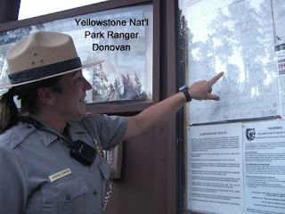
It was a surprisingly tough climb up and over from the east entrance to Fishing Bridge, taking several hours to traverse, but I made it. On the flat road following the northeast edge of Yellowstone Lake, I saw my first herd of bison just off the road, peacefully grazing in the grass between the road and the lake. They had been in the road, earlier – lucky for me, they weren’t there now, as it would have made the road impassable for me. I went into the RV park admin building to find out where I could go to camp, and got a big candy bar at the small store there, too ($4). Then I found out that: a) there’s no tent camping facilities here, and b) most of the other campsites in the entire park were closed for the season! The next closest open campsite was at Madison, only about 56 miles further west, on the other side of the park. And the Sun had just set. The people at the RV park called-in a Park Ranger, and when she arrived (Ranger Christine Donovan), said there was an open campground about 21 miles away. Okay, I would go for that one, but it would be night before I could make it there. I tried stopping at the store, and then the mini mart at Fishing Bridge, but they were both closed. Catching up to me, Ranger Donovan pulled up in her truck, and said that she’d made a mistake, and the campground she suggested was also closed, so we would have to figure out something else. We went back to the RV park, and she arranged with the staff there to let me stay (for free, even) (N44 33.832’ W110 22.115’), and I could put my foodstuff into the administration building overnight – how nice! So, that’s what I did. I kind of got the message, at this point, that bears are a very real concern around Yellowstone, and that stealth camping is *really* not a very good idea. I decided I would do what I had to, to avoid stealth camping while in Yellowstone. I gave Ranger Donovan my blog site, and she said she would check with her bear-knowledgeable people about the idea of using urine to mark your territory, and deter wildlife, including bears, from intruding on your space. I put all my food items in the building, set my tent up in amongst all the humongous mobile homes and RVs, and at about 8:30pm, was lulled to sleep by the yipping and high-pitched cries of coyotes off in the distance.

Day Two Hundred-six, 090922 - Wapiti, WY

Day Two Hundred-six, Date Tuesday, September 22, 2009
Time in Saddle: 6:03
Distance for the Day: 52.31 miles From Emblem To Wapiti, WY
Accumulated Trip Distance: 10,386 miles
Altitudes: Starting/Ending 4635’/ 5497’, Highest: 5506’ Accumulated: 2257’
Speeds: Avg: 8.6 mph, Max: 34.1 mph
Weather: 38° clear and sunny, warming to the lower 80s
Expenditures: $19

I woke and got up at 6:05am to a totally clear sky in the growing light of the morning; bright beautiful Venus shining its usual morning cheer. I broke everything down and was ready to roll at 7:03am. It was pretty cold this morning – I had to put on four layers on top (shirt, shirt, jacket, and rain coat), and three layers below (tights, other tights, and rain pants), and two pairs of socks. I discovered that fingered gloves don’t do much to keep my hands warm – should maybe think about getting mittens, instead. After starting off several hundred yards down the road from my camp, I saw four, rather rangy looking horses in the same field that I’d camped in to the west of my site. I didn’t know it at the time, but they were wild mustangs! I thought they were just some ranch horses, and didn’t think much about them. I saw another group of three about 45 minutes later (by then, I’d found out what they were), and took their picture, though they were much further away. You’re supposed to stay at least 500’ away from them, according to the signs that mark some of the entrances to their range. As the morning progressed, I slowly shed my clothing, layer by layer, until by about 11pm, I was back to just my basic riding clothes. I made it into Cody by about 11:30am, and stopped in at the first service available (a KOA) to make an emergency nature call, bought a couple of drinkables ($3), and continued into town, where I knew there was a Subway. I had a meal deal lunch ($7), and then went next door to the grocery store and got more food and Gatorade ($9). I then went down this rather steep hill to continue through Cody and find their library, only to find that they’d moved their library, and I had to go back up the bloody hill, again – I hate it when they do that. I got to the library, charged up my notebook and camera, posted a quickie blog, and took care of email. I finished at 2:45pm, and continued on to Yellowstone.

The road started going pretty steadily and almost steeply, up, and I had to pass through two short tunnels, and one really long, straight one – all without problems from the somewhat light traffic. At the end of the long tunnel, I stopped for a while at the Buffalo Bill Dam Visitor Center to take pictures of the facility and dam. I asked about stealth camping there, but they locked the gates at night, and the police came by to check the place out at night – so it was not a great option.
Continuing up the road, I found stealth camp at a trail head that was up and off the main road (N44 28.562’ W109 24.894’), at around sunset, about 7:30pm (a bit early due to mountains). It was getting medium dark, and one car was parked with some young people hanging out. I waited a while, and took pictures of the crescent moon, until they left. I then pushed my trike up a short, steep hill in toward a line of trees above the level of the lot, to make it even stealthier. I hung my hammock up in the trees, but was concerned a bit about bears, so with my weenie hanging out, I pissed a little bit all around my immediate site. As I may have mentioned before, I’d heard from two different sources that this was an effective way to let wildlife know this was my territory, and they would respect it. I was in bed by about 8pm, and read, munched, and drank until going to sleep about 9pm. A little after midnight, a truck quickly passed through to check things out, but they missed me. Then, at about 1am, I started hearing little rustlings, again; Demitol! More mice! I got up – it wasn’t too cold yet – put on my shoes, checked my food bags, and sure enough, they had been chewed a bit. So, I took a long piece of thin rope and hung my food in the bag from a tree. After hanging my food up, I went back into my hammock, and then one mouse climbed onto my hammock, and was scuttling over the mosquito netting above and to the left of me – I could see his outline. I whacked him with a quick backhand, and sent him flying. I didn’t see any more mice on my hammock after that, but I’m not sure if they were still able to get to my food or not. When I pulled down the bag in the morning, pretty much all my trail mix was gone. I can’t remember if the bag had been emptied before or after hanging it, but as of now, almost all of it was gone. Little bastards. I still had a couple of other small bags of trailmix – those bags must have been thicker or more airtight, as they mice didn’t touch them.

Day Two Hundred-five, 090921 - Emblem, WY

Day Two Hundred-five, Date Monday, September 21, 2009
Time in Saddle: 8:29
Distance for the Day: 72.29 miles From Ten Sleep To Emblem, WY
Accumulated Trip Distance: 10,334 miles
Altitudes: Starting/Ending 4605’/4635’, Highest: 4674’ Accumulated: 2657’
Speeds: Avg: 8.5 mph, Max: 24.9 mph
Weather: 38° mostly cloudy, clearing through the day
Expenditures: $9

Well, despite all the lightning and howling wind, buffeting my little tent, making me feel like there was either a gale that was going to send my tent tumbling over the field with me inside, or that a tornado that was going to pick me and my tent up, and send me to Oz, or at least Kansas, I survived, and even managed to get some sleep. At 5am, I thought I’d wait at least until dawn, to see if the wind would die down, then, which I notice oftentimes happens, and indeed, by 6am, it did. What I thought was the pattering of rain, was actually just windblown leaves hitting my tent. Miraculously, there was not one drop of rain the whole night, and everything was completely dry – pretty lucky! My trike’s cloak had completely fallen off, but was kept from blowing away by my weighing it down with water bottles. I don’t know if any passing motorists noticed me, but if they did, none of them did anything about it. That morning sky was amazingly nasty looking – overcast, yes, but it was dark and lumpy looking – it still looked like it could rain. The field was an already-harvested cornfield, and with most of the wind gone, I was able to quickly break down, secure my gear, and got the heck out of the dirt at 6:57am before rain might muddy me up after all (though I still took a bit of time to take some pictures – it was actually very beautiful).

I continued on my way, and as the day progressed, the sky became clearer and clearer, until it became a beautiful, mostly sunny day (yes!) with lovely, puffy cumulus spread out from horizon to horizon. The terrain changed from mostly flat farmland to mesas and desert which reminded me of Nevada, with mild grades going up and down. The wind came back, and gave me a nice, cold 10-20mph headwind, thankyouverymuch. I was thinking, as I often do, about how wonderful the roads of Wyoming have been – smooth, nice shoulders, light traffic – and then out of the blue, practically the moment I finished thinking the nice thoughts about Wyoming roads, the shoulder became un-rideable due to the start of a wide vibration strip in the middle of the shoulder! You know what it was: I’d forgotten to knock on wood when I was thinking how nice the roads were – foolish human! Now, I had to ride in the roadway, and dodge through the buzz strip onto the gravel shoulder whenever traffic came. Fortunately, this did not last very long, but why it was there at all was a real mystery. Visibility was excellent, and I could see 50 to 100 miles away, now, and saw the mountains to the west covered with snow – sure hoped I wasn’t going through those. I made it to the town of Manderson at around noon, but pretty much just passed it by. I then made the town of Basin by 1:30pm, and stopped at the mini mart for food and drink ($5). I just kept on truckin’, not stopping long at any place, today, as I did want to get as far toward Yellowstone as possible.

I made Greybull by 3:15pm, and stopped to get info on the terrain in and around Yellowstone, and the weather, via a moderately weak wi-fi signal I managed to pick up in front of the local grocery store (which also had an outside outlet I could plug into). The highest altitude I was likely to encounter in that whole region was about 8500’ ASL, and the weather looked very good for the next several days – excellent! More luck, just for me. I got some food and drink items at the store ($4), and took off west on Hwy 14 towards Cody, the gateway town to the east entrance of Yellowstone.
I found an ‘okay’ stealth camp site at 6:40pm along the highway on BLM property (Bureau of Land Management – aka, government) (N44 28.685’ W108 29.097’). It was all open, high desert – quite flat, with low, calf-high scrub, and I was fairly easily visible from the road. If nobody else minded seeing me a hundred yards from the road (if they even noticed), then I didn’t mind, either. I would have loved to see the stars from this clear, wide open plain, but I wasn’t quite willing to face the near freezing temperatures to do so. Perhaps I’ll be braver/tougher in Yellowstone. The sun set around 7pm, just as I was finishing setting up my tent. I cloaked my trike, and hopped inside with my bag of Fritos Honey BBQ Twists, a bottle of Squirt soda, trail mix, my book, and munched, swigged, and read until it got too dark to read, around 8pm. I was far enough away from the highway that the occasional traffic passing by was an insignificant whisper, and had no trouble falling asleep, especially since the night before had been a bit less restful. Zzzzzzz!

Day Two Hundred-four, 090920 - Ten Sleep, WY

Day Two Hundred-four, Date Sunday, September 20, 2009
Time in Saddle: 6:49
Distance for the Day: 59.60 miles From Big Horn Nat’l Forest To Ten Sleep, WY
Accumulated Trip Distance: 10,261 miles
Altitudes: Starting/Ending 6917’/4605’, Highest: 9666’ Accumulated: 4652’
Speeds: Avg: 8.7 mph, Max: 41.6 mph
Weather: 52° mostly cloudy, rain, then clearing and cool by evening
Expenditures: $33

I woke up several times throughout the night, hearing, or *thought* I was hearing, more rustlings. I really woke up at about 5:30am, but dozed until 6:20am, when I got up and secured my gear. I had a bit of breakfast at 6:40am of two bananas, some of that “tainted” trailmix (fingers crossed), and a Spicy Hot V8 to wash it all down. Gone was the clear skies of last night; now there were clouds all over the place, some rather ominous, with a few blue patches showing – about what I expected. During the night, I got real thirsty after eating a bag of salty ChexMix, which was a mistake. I was already a bit low on drinkables, and during the night, I had to drink almost a quart of Gatorade to slake my thirst, so I was now even lower on drinkables (not including the water). But, when it’s cold and wet or moist, I don’t need nearly as much to re-hydrate, so I wasn’t too worried. It was a gorgeous sunrise, so I took some pictures of that. The temperature dropped enough to need the rain gear to help keep me warm. At 7:10am I was ready to continue my ascent over the Big Horn Nat’l Forest mountain range, about a good 50 miles and 2700’ altitude gain from where I was to the town on the other side (Ten Sleep), come what may (weather-wise). It was, of course, tough, with several 7% grades, making me go to my lowest gear. I would go for as long as I could “comfortably” (hyperventilating with heart rates as high as 150 BPM), and then stop to rest, just to long enough to get back to normal breathing. I’d then continue on, until I needed to rest, again. I kept this up all the way to the summit, though the higher I got, the less I needed to do it, because the grades became progressively easier.

Before the first rain hit, I found a very nice restaurant called the South Fork at about 8am, where I had pancakes, eggs, hot cocoa, and picked up a couple of sodas for the road ($16 including the late tip). I talked with several of the people there, including the chef, the waitress, and some of the other customers, about my trip. It rained a bit while I was eating, but it let up again after 20 minutes, or so. Meanwhile, a pickup truck pulled in, and there was a big, dead moose in the back. It was bow hunting season, and this fellow really lucked-out. Not only did he manage to get one of the few permits available to hunt moose (I think it was something like 80 available to the thousands of applications), he got a big one; kind of like hitting the ‘hunters’ lottery.’ Everyone was jazzed about it – even the waitress, who had herself killed a moose once with bow and arrow. It didn’t do much for me, but I’m from the San Francisco Bay Area. I paid up and left at 9:40am, started chugging my way up the mountain again, and after a few hundred yards, I went “doh!” turned around, and went back to give the waitress her tip, which I’d forgotten.

Getting back on the road once again, I did get drizzled and rained on a few times – no downpours, but a few good, steady rain periods. On the long haul up, I fell into a kind of semi-conscious, half-lidded stupor to sort of ‘forget’ about the discomfort of the situation, which included cold, numb fingers and toes. I was conscious enough to stay on a straight course along the shoulder, but that was about it. I was only vaguely aware of the scenery or even the traffic, and I could rouse myself out of it any time I felt I needed to, but for fairly long periods 10, 20, 30 minutes at a time I was not all there – an interesting survival mechanism. The rain was light enough that I managed to keep somewhat non-drenched. I saw a small group of deer grazing by the roadside. (Have I mentioned this before?) They didn’t seem to take notice of passing vehicles, but when they saw me, they got very concerned, and went bounding away with their peculiar little hops. After I passed by them a few hundred yards, I looked back, and some of them were crossing the road in front of oncoming traffic. The cars had to slow down to avoid hitting them. I’ve seen plenty of deer carcasses on the road, and could see why.

I made the Powder River Pass summit, elevation 9,666’ ASL, at 2pm. The weather, here, was dry though still overcast and very cold. Back from where I came, it was still black and stormy-looking, and to the north and west, where I was headed, I could see patches of blue. Thankfully, it would be mostly downhill, now, but ‘wow’ – I sure wasn’t expecting such a scenic ride down. The weather on this side of the range cleared completely, with plenty of warm sunshine and dry air. During the fast, steep descents, I took helmet cam video, and stopped now and then to take pictures, too. It was so amazing – reminiscent of the Grand Canyon, though not quite as big. Also amazingly, by the time I got down to the bottom, I and all my gear was completely dry, again, and the weather was now quite temperate – bonus! Unfortunately, a very temporary bonus, by the time I made it to the bottom, the sky had begun to cloud up, again.

From 4:45pm to 5pm, I visited the Ten Sleep Fish Hatchery – I’ve always wanted to visit one of these facilities, and finally did – it was very cool. This particular one cultivates and stocks Yellowstone with cutthroat trout, among several other species. They even had a 25-cent candy dispenser thing for a handful of fish food pellets, which I got, and threw into the pond with big fish in it. Looked kind of like piranha in action! I stopped in the small town of Ten Sleep at about 5:30pm, and got drinks and food items ($7) and also stopped in the local café to get a burger and salad ($10), and to charge up my notebook and camera batteries. Unfortunately, my camera battery is starting to fade (won’t hold a charge for long), which means I’ll either have to buy a replacement camera or, if I can find one, the proprietary battery. I’ll check online first chance I get.
By the time I left the café at 7:30pm, the sun had already set, and it was getting downright dark out. I wasn’t seeing any good possible sites near town, so I kept moving along my chosen route, which turned north. I kept going, and going, and not seeing any good possibilities. At one point, I noticed the shapes of four animals of unknown type, running along and keeping pace with me. I couldn’t quite tell if they were horses, or dogs, or what, it was that dark, but they must have gotten stopped by a fence at the end of the field they were in – that was a little weird. It got to very dark, mostly because of all the cloud cover – otherwise, there would have still been *some* light in the evening sky. I was still not finding anything good looking, and then I began to see a few lightning flashes in front of me, and to the rear, too (no, or very-delayed thunder). This put an extra sense of urgency to the matter, for me, as I really did not want to have to set up camp in some muddy dirt field in the rain. So, I found a dry dirt field right next to the road (N44 3.758’ W107 29.394’) that had a short, steep gravel and dirt drive down to it. I walked down to scope it out a bit, and thought, ‘good enough.’ I brought my trike down, set up my tent, cloaked my trike, and hopped in by 8:30pm. No rain, yet, and very occasional car headlights or lightning flashes, still without thunder, lit up my tent. Sure hope it don’t rain, because if it does, I’m going to have some muddy gear to pack away, and may even have trouble getting my trike back up to the road – ugh! At about 9:30pm, the wind picked up, strong. It would cause my tent to warp and sway, and it’s such a narrow tent, it would nudge me, making sleep kind of difficult. I hoped it would die down, but it didn’t – it kept up, and kept waking me up, the whole night.

Day Two Hundred-three, 090919 - Big Horn Nat'l Forest

Day Two Hundred-three, Date Saturday, September 19, 2009
Time in Saddle: 6:55
Distance for the Day: 56.07 miles From Gillette To Big Horn Nat’l Forest
Accumulated Trip Distance: 10,202 miles
Altitudes: Starting/Ending 3965’/6917’, Highest: 6923’ Accumulated: 4449’
Speeds: Avg: 8.1 mph, Max: 33.2 mph
Weather: 46°
Expenditures: $17

Woke up at 5:50am and got up at 6am, broke down and ready to roll by 6:36am; totally clear all around, beautiful Venus, munched a little for breakfast, and took off at 6:42am; stopped at a rest stop and met Cha Cha, a retired Korean man, who is traveling the world on his Harley Davidson motorcycle! We admired each others’ rigs, and he kept telling me, “You’re the *real* Man!” and grabbed, squeezed and shook my thigh – hah! He was a real fun and funny guy, and had a lot of high spirit in him. I reached the town of Buffalo at 12:30pm, which was just before the Big Horn Nat’l Forest mountain range, on my route. I went to the tiny Visitor Center, where I got good advice from the lady there on how to shorten my route to Yellowstone a bit. I noticed a basket of used novels, and brought in my Stephen King book to add to the collection. She told me I could pick up a novel from the local library for free, because they’re not significant or long-lasting enough to actually keep track of. For a change, I got a Fuze drink at the local mini-mart ($2) – but didn’t like it that much. I then made my way, with difficulty, to the town library. (They’d moved it, but forgot to tell Street Atlas. I went down a big hill to the old location, where a sign there said it was at a new location, back up that big hill – I hate that.) Once there, I perused the choices and picked up “The Harbinger,” just some page-turner by an author I’d never heard of. But, hey – free book!

At 1:41pm I was getting ready, stocking up on supplies before leaving for the (ulp!) highest mountain pass I’ve hit since Hwy 666 in Arizona – the Powder Horn Pass in the Big Horn Nat’l Forest at 9,666’ ASL (there’s that ‘666’ reference, again – I swear I didn’t make it up – it’s in the picture).
Went over to the library to check the weather, the forecast called for 40% chance of rain tomorrow – light during the morning, heavier during the day – thought about staying in Buffalo to wait out the weather, but wasn’t sure I’d be able to get wi-fi on Sunday, ditzed around town, spent $15 more for more food/drinks; wanted to get it over with, so left; headed up at 3:40pm stopped several times up the road now 5:17pm, I corrected my elevation using Google Earth so was at about 4700’ ASL in Buffalo, and made it to 6234’ so far, today; would like to get to at least 7000’ or more, today, which would leave only 2666’ left to go, which wouldn’t be too horrible for tomorrow; N44 19.394’ W106 53.439’ Found an open-air, drive-up interpretive display in its own parking area for the Big Horn Nat’l Forest – a paved circle with a sidewalk for the information boards;this was a nice clean spot, and I wasn’t sure there would be anything up ahead, so I set up my tent, there. A father and son arrived in a small truck and parked. They were in camouflage outfits, and the father had a wicked-looking compound bow. They were going bow hunting, and left me alone. One other car swung around the circle after dark, but they didn’t even slow down, and left. That was it. It was a perfectly clear night, and I was set up and inside by 7pm. I read, munched, and drank my soda until it got dark, around 7:30pm, and then went to sleep, or at least started to. I heard this rustling noise coming from my trike, and at first couldn’t figure out what it was. Wind? I’d left my tent fly off, and the stars were blazing away, but this rustling noise kept happening. I wondered if it could be mice getting at my trailmix. Finally, I couldn’t stand it anymore, and at around midnight, I got up and out, checked my bag of trailmix, and sure enough, it had been chewed through. I never saw or heard the mice, but knew that they’d been there. At first, I grabbed the bag, wrapped it up in a couple of spare shopping bags (of which, I always try to keep a few), and brought it into the tent with me. Then I had two thoughts: what if they have lice, or fleas, and left some on the bag; and, what if they decide to try to chew a hole through my tent to get to the food? I got up again, and stuck the bag into one of the trike’s driving handles. I seemed to keep hearing rustles going on, but it might have been my imagination, as they didn’t bother that trailmix again, that night. The air was calm and somewhat cool, but the stars were just aglitter – a vast expanse of familiar constellations, shining brightly and easily traced (no light pollution or haze to hide the fainter stars) and the Milky Way was just gorgeous! Oh, I had one *other* thought poking at my brain just before I fell asleep: should I now just toss that whole bag away, or was it still safe to eat? Find out tomorrow, what I decided.

Day Two Hundred-two, 090918 - Gillette, WY

Day Two Hundred-two, Date Friday, September 18, 2009
Time in Saddle: 7:14
Distance for the Day: 72.08 miles From Moorcroft To Gillette, WY
Accumulated Trip Distance: 10,146 miles
Altitudes: Starting/Ending 3570’/3965’, Highest: 4403’ Accumulated: 2884’
Speeds: Avg: 9.9 mph, Max: 33.8 mph
Weather: 43° clear and dry
Expenditures: $14

Sunrise was just about 6:51am with bright, beautiful Venus; stopped off at Moorcroft from 10:20 and 11:40am, had small lunch of Fritos twisty chips, soda, and apple, ($7) made it to Hwy I-90, and found that, yes, cyclists are allowed on it (at least, there were no signs prohibiting them). So, I will use it to get to Gillette, and points west, on my way to Yellowstone. Michael Johnson my interviewer from the Gillette News Record paper at 3:23pm at Subway – see the article at http://www.gillettenewsrecord.com/articles/2009/09/21/news/today/news00.txt ; 4:43pm took a quickie 10 minute sponge bath in the bathroom of Subway, charged my notebook, uploaded photos from my camera, and even blogged a little. 4:57pm got my picture taken by Nate Payne with the same paper.

At about 3pm, I stopped at a tire shop in Gillette to get directions to the nearest Subway and the man and woman there asked me about my trip and took my picture. I gave them my blog site, and they must have called the local newspaper, because while I was at Subway, David Johnson, from the local newspaper, came and interviewed me while I was having a meal deal ($7). After the interview, I charged up my laptop while I ate, and did a bit of blogging. After I finished, I left, and got back on I-90 towards Buffalo. I didn’t get very far, before I noticed a car parked on the shoulder, ahead, and some fellow was photographing me with a nice camera. David did mention that a photographer would be out on the highway, wanting to take my picture, and by golly, there he was! I stopped and we chatted; he asked me more questions about my trip, and then he drove ahead of me two more times to get pictures of me on the highway, and then he went on his way, and I continued on mine. So, I’m famous, again – whoo-hoo!

I like riding on interstate highways; they usually have wide, mostly clean shoulders, and smooth over the terrain with gradual rises and falls, presumably to facilitate high speed travel. The bad news with interstates: you don’t necessarily get to experience the land as well – they’re not as intimate. But, for those times when I have used them, it was because they were the only viable route, and indeed: those are the only times a cyclist *can* use them. Even though this was an interstate, I still saw a herd of antelope along the way. They seem to pretty much ignore the zoom and roar of normal traffic, but when they see me, they get alert, nervous, and start running away. I guess I look like a predator, being low and slow. Pretty funny! I rode as far as I could, until the sun got low on the horizon, and then took the next exit at about 6:40pm. I followed it up to a dirt road that had a “private property” sign on it, but it was open. I looked down and to the right of the hill where the gate was located, and saw a rather large herd of antelope about 150 yards away. As usual, they noticed me, and started to move away. They were in a large area where three large, somewhat flat, circular tanks were positioned across from a medium-sized square block of a building with a huge fan on one side of it. I sat and waited – sunset occurred at right about 7pm – and noticed a couple of workers moving around. At one point, the fan in that building fired-up and roared like it was getting ready to launch. After several minutes of that, it stopped, and the worker guys got in their trucks and started to exit the facility. As they came by me to get to the highway, I stopped the first one and asked two questions: what the heck was that facility (a methane collection and storage plant), and if they thought anyone would mind my throwing my tent up just a bit up and to the left of the gate. They said the landowner was a pretty good guy, and probably wouldn’t know, and if he did, wouldn’t mind. Cool! I set up next to a CAT scraper (N44 10.860’ W105 54.272’) to protect against the wind, a bit, and watched the remains of the gorgeous crystal clear high-plains desert sunset, with mild temps in mid-to-high 70s. The methane plant itself made a steady white noise, but wasn’t bad. By now, there was hardly any wind, and at 7:26pm I hopped into my tent with soda and munchies, and finished my book, Stephen King’s “Skeleton Crew.” by 8pm – then went to sleep. It’s still 46 miles to next service, and I was running a little low on liquids, but I should be okay. This night, I didn’t put on my tent fly, so I could see the stars any time I woke up enough to look, which happened several times throughout the night. I might’ve even been okay to sleep out without the tent, but I wasn’t sure what the bug situation was like, so played it safe.

Day Two Hundred-one, 090917 - Moorcroft, WY

Day Two Hundred-one, Date Thursday, September 17, 2009
Time in Saddle: 6:40
Distance for the Day: 51.31 miles From Alzada To Moorcroft, WY
Accumulated Trip Distance: 10,074 miles
Altitudes: Starting/Ending: 2994’/3570’, Highest: 3911’ Accumulated: 3094’
Speeds: Avg: 7.6 mph, Max: 35.8 mph
Weather: 45° clear, warming to mid-70s
Expenditures: $39

Woke and got up at “5:35am.” It was still night out, not even astronomical dawn, yet. The Wintertime constellations and stars were glorious, Venus was just rising in the east, and had an orange tinge to it, and in fact, I could even make out the Zodiacal Light, aka “false dawn,” which is the glow from dust particles in the plane of the solar system left over from the formation of planets, still in a flattened, disk-shaped cloud, sharing its orbit around the Sun with the planets. I was waiting for the store to open at 6am, and when it got to that time, they didn’t open, and it was still pretty dark out. Hmmm, I peeked inside and saw the wall clock; it said it was 5:05am. That’s when I knew I was in the next time zone. So, I put on some more clothes against the cool morning air, and just counted constellations, deep-sky objects, and watched the thin crescent Moon rise over the eastern horizon; it kinda reminded me of a solar prominence as seen through an H-alpha solar scope. As it rose fully above the horizon, I could see the whole sphere of the Moon, its dark side faintly lit by Earthshine. Very cool. When the store opened at the local 6am, I went inside and got a egg/sausage/muffin sandwich ($4) for breakfast, and resupplied my fluids and food items ($15), and took off across the street at 6:34am, still before sunrise, to the start of SR 112 to Hulett, and Devil’s Tower.
An early morning achievement: a few minutes after sunrise at 6:48am, I entered the State of Wyoming at 6:59am! The road was hilly, and even a bit mountainous, but I took it easy and steady, and made it the 31 miles to Hulett without trouble by 11:20am. I saw real mountain bluebirds along the way, and a flock of redwing blackbirds flying through a forest. There were birds of prey, a couple of vultures, and a lot more antelope. I stopped in Hulett at 11:30am and got a hamburger and fries lunch ($14), recharged my laptop and iPod, and blogged. I also stopped for a soda ($2), and also at the local hardware store to pick up a roll of fluorescent tape ($2) to make as many ding-dong flags as I should need. I continued on at 3:15pm towards Moorcroft. The big bonus of this particular re-route was the chance to pass by The Devils Tower mountain, which I made at 4:30pm. It was pretty spectacular, and I took a bunch of pictures of it. I stopped at a small roadside tourist shop and got an orange crème bar ($2), then at 5:03pm, continued through the somewhat hilly terrain toward Moorcroft. On the way, I saw a handful of deer about 40 yards from me on a shaded, tree-studded hillside to my right. They froze, but when I waved at them, they moved a little, still unsure if I was a threat or not. I moved on, an so did they. As the sun got low on the horizon, I looked for a good stealth camp, and found a volunteer firehouse at 6:40pm, just off and above the road (N44 29.726’ W104 46.884’). It had clean gravel around the back, and was concealed from all but the most eagle of eyes. I hung out reading my book until 7:20pm, when the Sun set, waiting for it to get a little darker, before setting up my tent. I didn’t need to use my tent fly, as it was warm and dry – no mosquitoes, ants, spiders, slugs, etc. I think that must be why there’s not much astronomy in states like North or South Dakota, Nebraska, etc. The mosquitoes would be murder. There was one light above the back door, but it didn’t bother me, so I cloaked my trike and was in bed by 8pm, munching on trailmix, Spicy Hot V8, and some soda. There was *some* car noise from the road, but it was lightly traveled, and not very loud. I woke up at 1:05am and tongue was completely dry – my nose was a little stuffed from the dry air, which made me breath through my mouth. I drank up the rest of my soda, and went back to sleep. I’m sure the stars were blazing, but due to that light above the door, I couldn’t see them. Phooey!

Day Two Hundred, 090916 - Alzada, MT

Day Two Hundred, Date Wednesday, September 16, 2009
Time in Saddle: 7:09
Distance for the Day: 65.38 miles From Ekalaka To Alzada, MT
Accumulated Trip Distance: 10,022 miles
Altitudes: Starting/Ending 3139’/2994’, Highest: 3530’ Accumulated: 1512’
Speeds: Avg: 9.1 mph, Max: 32.1 mph
Weather: 50° clear and dry, warming to the low-90s in the afternoon
Expenditures: $19

Woke up at 6:08am got up at 6:20am broke down ready to roll at 7:05am after using the church bathroom, again (thanks Father DeForest!) The crescent moon was in a pretty conjunction with Venus, a very close pass by each other; also got to see Mars for the first time this year in the constellation of Gemini. The weather this morning was beautiful and dry, and I heard a coyote howling at 5:30am which set off all the town dogs. I went into the church to have a sit and plug in my notebook, but all their outlets were the two-prong type, which I couldn’t plug into. I then left to go into town, and noticed the doors to the local bank were open at 8:36am. They weren’t open for business, yet, but let me have a sit and plug in just the same. I spoke with the manager, Mike Quady, he gave me valuable intel on routes I should take. I decided at this juncture to skip going to the Grand Tetons National Park, unless it doesn’t seem too bad to go down to them from Yellowstone and then back up through Yellowstone to West Yellowstone. I was already losing time with the reroute, and if I try, as I originally intended, to get to the Tetons, first, and then Yellowstone, second, it would take a lot longer, and I don’t think I have the time. Mike even gave me a promotional Ekalaka Bank cap (thanks, Mike!)

At 10:11am, I stopped in at the town café for breakfast (eggs, hash browns, toast - $7). I thought I’d better get a decent breakfast, because I wasn’t going to get lunch, or possibly dinner, either. Surprisingly, there was a strong wi-fi signal coming from *somewhere* (it wasn’t the café’s), and I was able to handle email, check weather, and use Google Maps. Afterwards, I took off, already stocked-up from yesterday’s trip to the grocery store with three quarts of Gatorade, two quarts of water, and four pints of sodas.

Woo! Tough day. The sun was hot, but thankfully, the air wasn’t just as hot – probably only in the mid-80s, plus, there was almost always a slight to moderate breeze out of the east. This turned out to be most helpful, which I’ll explain later. I started down my new route for the day, the one suggested by the guy who told me the gravel road was no good, yesterday, which was Hwy 323 to Alzada, a 72 mile stretch with no services, a 15 mile stretch of gravel road, the last 6 miles of which were under construction (as described, yesterday).

The first 30 miles of 323 went very well, with nice pavement, light traffic, and gentle breezes to cool me off in the warm sun. Very peaceful out here, with very little traffic, and I can hear the birds singing in the trees and not much else. The gnat problem has for the most part stopped, but the grasshoppers seem to have redoubled, with them jumping up as I approach, and hitting me in the face, chest, arms, legs – kind of annoying, though harmless. Once, one even got under my shirt – I had to stop for that. I went over a 500’ mountain pass, through the Custer National Forest, and past the Medicine Rock Park. I didn’t go into the park, but saw some samples of the weird, carved shapes of that region. I saw two gray deer leap over the roadside barbed wire fence, bound over the road, and then leap over the other barbed wire fence on the other side. They were only about 40 feet from me, and their movements were just astounding – they seem to give these little kicks, and then they’d rise up and over 4’ fences as though they were floating through anti-gravity fields. There was also a gray stag with a full ‘rack’ (antlers), but he didn’t like the looks of me, and turned around and hid behind some of the medicine rocks. Then, I got to the gravel road. Yeesh!

At first, it was a bit tough, trying to find ‘paths’ – usually where tires passed the most, that were somewhat free of gravel – that I could grip and travel on faster. Also, there was the fairly heavy traffic of huge ‘extra-long’ gravel carriers. I found that if I stayed on the *left* hand side of the road, the wind would carry most of these vehicles’ dust clouds off to the right, away from me. The drivers understood what I was doing, and helped by driving on the wrong side of the road when they passed me – most considerate. Fortunately, no convergences occurred (vehicles approaching from the front and the rear, right as they passed me), so I actually (amazingly) got very little dust on me for the 10 gravel miles I rode. There *were* fairly long stretches where the road became pretty decent – compressed dirt, which was smoother and easier to ride, so it wasn’t all bad. The fellow I’d talked with the evening before (the one who told me the gravel road from Ekalaka to Broadus wasn’t do-able), drove up in his truck, and offered to give me a lift over *this* gravel. I thanked him, but turned down his offer – that would be cheating! I wondered if I was going to regret that.

I went along as best I could, and refused to look at my odometer. I find it’s too torturous to keep looking at the odometer when you’re suffering. In circumstances like this, it’s best to keep it out of mind, and be pleasantly surprised when you’ve reached goal. Believe you me: time flies by a lot quicker when you’re not watching the clock/odometer! I eventually passed over the 10 miles to where the actual road construction was happening, and one of the supervisory type guys called me over, and offered (in a friendly, though somewhat insistent manner) to give me and my trike a ride the rest of the way past the construction zone, and to pavement again. There were huge scrapers and loaders working the last 5 miles toward Alzada, and they have trouble seeing cars and buses, much less tiny little gnats like me. I accepted, in truth, gratefully, as I was getting a little knackered riding over this slow, tough road. We loaded my trike, and he drove me over the last 5 miles of gravel, past all the big construction machines. Looking at that road, I was glad to be getting that ride – it was big, thick gravel, no bald spots, and would have been super-tough to traverse – I probably would have made a top speed of 4-6 miles per hour on that road. We got to the paved road, and he let me off, there, and we chatted a bit before I thanked him for the ride, and he took off. I noticed my brand new trike flag was starting to come off its pole! I thought, “I should shoe-goo that on,” and then got thirsty and drank some Gatorade and promptly forgot about it. My best excuse was – I was a bit loopy from the heat, thirst, and no food since breakfast. It was 20 more miles to Alzada – my legs and knees were already a bit strained, but, 20 miles isn’t *so* bad. I had muscles that were a bit painful, and had to use the leg-stretch trick to keep my knees from flaring up. A ways down the road, I remembered the flag, looked up, and it was gone. DEMITOL! It wasn’t that breezy, but when these huge rigs go zooming past at warp speed coming from the opposite direction, they hit you with a hefty gust of wind, and I figure it was one of those times, which occurred at least several times every half hour, that I lost it. Now, I need a new flag, again. I think I’ll just get a roll of that thin, stretchy, fluorescent plastic tape, and make a bunch of tassels for the damn thing. Ach-patooey! I was feeling weird at this point – kind of weak and breathless, and knew I needed to eat something, but I wasn’t hungry, only thirsty. I forced myself to choke down a PayDay bar and a meat-n-cheese stick, and felt a little better.

I eventually made Alzada at 6:30pm, and got one of those “been cooking all day” Polish sausages (it was pretty good – but maybe that’s just because I was very hungry) and a root beer for dinner, plus got a couple more drinks for tonight and tomorrow morning ($12). I found out that I could camp at this location for free, so at 7:20pm, with the sun just about ready to set, I decided I would stay here for the night, and have breakfast here, too (N45° 1.439' W104° 24.365'). Tomorrow, I would head down SR 112 to Hulett. I’m told it’s a 31 mile, *very* hilly road – terrific. But, it’s paved the whole way, lightly traveled, and also goes past Devil’s Tower (you’ll remember that from the movie, “Close Encounters of the Third Kind”). And, it’s part of my new, viable route into Yellowstone. I’ll have to go on Interstate 90 for a while, but I believe it should be cycleable. I’ll find out if it’s not when I get there.
I blogged from what I *thought* was 7:40pm to 9:30pm, and chatted with a couple of truckers who were also staying overnight, plus the gal who was working the mini mart that evening. Everyone left after a while, but one of the truckers came back with a couple of pints of ice cold water bottles for me – his donation to my trip – that was nice! Then, I set my tent up on the concrete walkway right next to the store. As I was setting up, I saw a medium-small tarantula scuttling across the concrete near my tent – cool! I like tarantulas. They’re quite harmless, and very interesting insects. I chased him around a little bit, and then let him on his way. I got to bed by what I *thought* was 10pm (I had passed into the next time zone [Mountain Time] without knowing it, so the time was actually 11pm). The noise from the nearby highway was pretty loud, even with my earplugs, but that didn’t matter – I was out like a light within 15 minutes.