Sunday, November 22, 2009

Trip Summary is coming!


Hi all: Thanks for hanging out with me -it's been a blast! I'm working on the summary, now, and will post it within a few more days. After that, I'll really be done (holy shmoly!) If you have any questions, please do let me know, and I will answer them in the trip FAQ.

Until we meet again, happy trails, and may the stars shine down upon you!

Cheerios! (crunch, crunch)
;~Don
Day Two Hundred Fifty-nine, Date Saturday, November 14, 2009
Time in Saddle: 3:38
Distance for the Day: 27.86 miles From Stinson Bch To San Francisco, CA
Accumulated Trip Distance: 12,613 miles
Altitudes: Starting/Ending 32’/22’, Highest: 207’ Accumulated: 806’
Speeds: Avg: 7.6 mph, Max: 30.1 mph
Weather: 40°
Expenditures: $13

I woke up all through the night every now and then, but would go right back to sleep, again (as usual). Once, at 4:15am, I poked my head out to check the weather and to see the beautiful stars. Orion was now leaning down, heading toward the western horizon; Mars was in Cancer, Sirius sparkled like “a diamond in the sky.” At 6am, I woke up for real, and got up to see a thin crescent Moon while I broke down my gear as the dawn brightened. Venus just popped its head up over the hills, and Sirius was still visible, though no other constellations were. There was quite a lot of moisture on the inside and outside of my tent fly, but I ignored it, as I knew I’d have plenty of time later, to dry out all my stuff. There was a pretty heavy stream of clouds coming out of the Golden Gate, beyond the town of Stinson to the south. I hoped they wouldn’t be sitting on any of the hills I planned to ascend. I didn’t see it last night, but at the further end of the lot, there was a small sign that said ‘no camping.’ Well, I don’t consider what I do really camping per se; I call it ‘overnighting,’ as I don’t light a fire, or cook food, or lounge around enjoying the scenery (much). I just set up my tent, hop inside, and after a while, go to sleep. Then in the morning, I get up before sunrise, break down, and am out of there without bothering anyone, and usually, without anyone even knowing I was there. That’s my story, and I’m sticking to it. I’m sure by now, you’re quite familiar with my modus operandi, but I might not have ever explained how I justify my actions, which are admittedly not necessarily aligned to the letter of the law, but are so harmless, it’s hard to imagine anyone being even more than mildly irritated. Except, of course, for Mr. Pecs (Day Eighty-seven).

I made it into the town of Stinson Beach, proper, at 7:20am. I passed the familiar businesses along the way, noticed they had a new library I’d never seen before (I’m very familiar with this town, as I fly my hang glider from nearby Mt. Tamalpais, and land on the beach, here.) I stopped in at the mini mart, but they wouldn’t open until 8am, so I just pushed on.

After climbing up from Stinson along Hwy 1 on the ocean-facing mountains of the Marin headlands, it being Saturday morning, I called my Auntie M at 7:55am and chatted with her while looking out over spectacular ocean views. She was very excited that I would finish my excursion, and would be coming home. I could see the land across the waters of the Golden Gate, and could see the Farallon Islands away off in the ocean to the west. I continued to slowly work my way up this mountain, and quickly enough took off my jacket because as cold as it was, I was starting to sweat. I topped the mountain at 8:50am, and had a nice coasting ride all the way down into Marin City, where I stopped for breakfast at the Shorline Coffee Shop. I ordered eggs, toast, hot cocoa and hash browns ($13), and ate from about 9:15am to 10am. From there, I went into Sausalito to look for the route into the Ft. Baker Military Reservation that Street Atlas said was there, but for the last time, it tried to take me straight up a super-steep hill. On consulting with a local, I found out the route I wanted to find was a road that literally turned into a set of stairs. Hokay. I gave up on that route, and just took the road/bicycle route out of Sausalito towards the Golden Gate Bridge. It was getting pretty late in the morning – almost noon, by now. I had posted in my blog that I expected to finish some time between 1pm and 3pm, and I thought I’d better not try to get into the military reservation, or I’d be late. Along the way, though, I re-discovered the tunnel road that led into the military reservation (I’d been on it before, but coming from the other direction), and decided I could still make it without being too late. So, I rode the easy path that included a cycle lane, through the tunnel and into the military reservation. From there, I was able to find the road that would take me up and over the small mountain to the south Marin headlands, which has these amazing views of the GG Bridge and San Francisco. The grade was moderately steep, and shorter than I remembered, so I reached the top a lot quicker than I thought. I stopped to take some pictures and set up my helmet cam, and then continued down the steep road to the cyclist entry of the Golden Gate Bridge. I thought I might have to navigate some stairs getting onto the sidewalk that I would ride across, but either they changed it to make it easier, or I just forgot how easy it was, but all I had to do was ride through a large parking lot filled with cars and other cyclists (getting a lot of smiles as I whizzed past), and then zipped up and onto the bridge’s pedestrian and cycle path. I crossed the mid-span of the GG Bridge at 12:50pm, took some pictures, and headed down into Ft. Point to greet my family and friends.
After reaching the south end of the bridge, I proceeded to the road that took me down to Ft. Point, right at water level, and was heading toward my original Start Point 8 months, 14 days ago, when my old boss, Bill T, called my name. Hi Bill! We chatted as we continued the few dozen more yards to the Start Point in front of the fort, and when we got there, I looked around, and no one else that I knew was there. Hey! Where were my adoring fans? Nobody. Well that was a bit of an anti-climax. Eventually, family and friends did start to show up. Nobody thought I would be on time, so no one except Bill showed up on time. I had no idea I had such a reputation, but, as was pointed out to me later: in my earlier blogs, I described on several different occasions how I would misestimate arrival times, so that’s why everyone thought I would be late, this time. Demitol. Here’s who eventually did show up: my former boss, Bill T of the University of California; fellow amateur astronomy friends and co-volunteers, Debbie D and Rod S; former co-worker Steve O and his girlfriend Vicky; my sister Bev and her husband Hector; my hang gliding buddy Dave G; and my brother Rich and his wife, Dian (who had to come the furthest – from south San Jose!) After all the celebratory congratulations, hugs, handshakes and fielding a gazillion questions about the trip, folks started to leave, so at around 2:30pm, we loaded my trike into my brother’s truck, and then left Ft. Point at 3pm, heading over the Bay Bridge to Oakland, and home. Once there, we unloaded stored my trike in the garage, and then went over to pick up my uncle to go out for a celebration dinner at a fancy restaurant (Skates), in the Berkeley marina. After *that*, we all said ‘goodnight,’ and went back to our various homes. I got to sleep in my own bed, again: quiet, warm, dry, with all the familiar LEDs silently and gently blinking me to sleep. Well, I’m back.

Day Two Hundred Fifty-eight, 091113 - Stinson Beach, CA

Day Two Hundred Fifty-eight, Date Friday, November 13, 2009
Time in Saddle: 6:47
Distance for the Day: 63.71 miles From Jenner To Stinson Beach, CA
Accumulated Trip Distance: 12,585 miles
Altitudes: Starting/Ending 92’/32’, Highest: 223’ Accumulated: 1387’
Speeds: Avg: 9.3 mph, Max: 41.6 mph
Weather: 43° clear and cool, warming to the mid-60s
Expenditures: $30

I woke and got up at 6:15am to a perfectly clear sky, with a bit of breeze out of the north. The light of day was enough that I couldn’t see the stars, but the crescent Moon stood out in the pale blue in sharp relief. Someone from the fort was walking outside the walls, coming up from the ocean headlands, and probably noticed me, but I was halfway done breaking down, and they were several hundred yards away, so I didn’t worry much about it. I rolled out at 6:55am with the light of day continuing to brighten; a beautiful, peaceful day on the Pacific. Last night, I heard a dozen or more coyotes across the highway and up in the hills go into an extended chorus, cows mooing in the field (also across the road), and a couple of hoot owls this morning. Sure is a noisy neighborhood, around here. Early on along the way, I saw a vulture soar cross the crescent Moon, forming a kind of mystic ‘x’ in the sky. When I got to the town of Jenner, I stopped from 8:50am to 9:04am for a mini mart breakfast of hot cocoa, muffin and Danish + food items ($10). I continued down the coast, stopping now and then to take pictures. Passing through Bodega Bay, I made certain the birds weren’t acting strangely (see Alfred Hitchcock’s movie, The Birds). I stopped at an internet café in Tomales for lunch at 12:40am, where I got a hot pastrami sandwich and soda ($11), and posted the ETA to the blogsite, as promised. I continued on at 2:04pm; the sky was still mostly clear, but now had a thin, high layer of cirrus clouds that filtered the Sun a bit. I had now entered the first, somewhat familiar terrain I’d seen since leaving Seattle, having been this far north along the coast once before, long ago, and stopped in Pt. Reyes from 3:45pm – 4:05pm to get ice cream ($3) at the grocery store. (Actually, I *did* visit the coast near Mendocino once, on an outing from my former boss’ Joe A’s home in Comptche – he would invite his staff there every now and then just for the fun of it. I didn’t recognize the area, though.) Back in Pt. Reyes, I also visited the used book store to trade in my old book (Mutation), and got another thin book: Six Arguments for Atheism ($6) – ought to be interesting.

It was still a good 17 miles to Stinson Beach, and with less than an hour before sunset, I knew I’d probably be riding in the dark to make it there, but I resolved to do it, no matter what, and I did pretty good – by the time I did get to just before Stinson, the sun had already set, but it was twilight, and still light enough for me to see the road and surrounding land fairly well. I found a semi-large lot off the side of the road at about 5:20pm, with a couple of piles of debris, one of which I could hide behind enough to go unnoticed by the drivers passing by (N37 55.856’ W122 41.340’). I parked behind the bigger pile, and waited for it to get darker. Once it did, I set up my tent, cloaked my trike, and was inside by 5:55pm with food, soda, and new book. I recorded the daily stats before munching, drinking, and reading, and went to sleep by 8:15pm. Tomorrow, I knew I’d be doing some mountain climbing, but I’ve done these hills before, and as I recalled, they weren’t too terribly bad. Of course, there were a lot of differences between the last time I did this route, and now: I was at least 15 years younger the last time I did them, but my legs weren’t nearly as developed as they are, now; but I wasn’t hauling an 80 lb. load back then, either; but my old bike didn’t have the low gears this trike has. Overall, I thought it should be pretty easy, and should go fairly quick. We’ll see. You know, for a Friday the thirteenth, this one wasn’t bad.

Day Two Hundred Fifty-seven, 091112 - Jenner, CA

Day Two Hundred Fifty-seven, Date Thursday, November 12, 2009
Time in Saddle: 6:34
Distance for the Day: 63.94 miles From Albion To Jenner, CA
Accumulated Trip Distance: 12,521 miles
Altitudes: Starting/Ending 19’/92’, Highest: 136’ Accumulated: 1383’
Speeds: Avg: 9.7 mph, Max: 43.9 mph
Weather: 38° clear and cold, warming to the low-to-mid 60s
Expenditures: $35

As is often the case, I woke up at various times during the night, and got up briefly at 2am to drink the rest of my ‘reserve’ soda, then woke up for real at 6:11am, and got up at 6:15am. There were two more cars around 5am or 6am that left the area this morning (I wondered if they were the two cars that went in last night). A lovely crescent Moon hung fairly high in the southeast in the totally clear sky. The dawn was bright enough I couldn’t see any stars; I could hear a flock of redwing blackbirds in the reeds between myself, and the Navarro River. I broke camp, stowed my gear, and was ready to roll by 6:49am. A slight breeze blew, but the big surprise was that clear sky; I wasn’t expecting that. From the weather predictions I got while up at the 3Ps, I thought it would be at least partly cloudy or even a bit of rain. I guess heading south got me out of the cold front’s path, except I thought I took that into account by checking weather forecasts for points down along the coast. Anyways, I wasn’t complaining. I stopped in the town of Elk from 8:15am to 8:41am for a breakfast of eggs, toast, and hot cocoa ($10) at Queenie’s Roadside Café. I talked a while with a local, Brett, who owns a house that is almost right on the edge of an escarpment facing the ocean – lucky guy. We chatted about my trip, and I gave him a tip on how to view more green flashes (use binoculars just before the last bit of Sun disappears). Continuing on, the Sun was now shining brightly, but it was still very cool, out. I would have to start using my face mask, again, to keep the UV off me. I stopped for 10 minutes at 10am to do my civic duty, and picked up dozens of nails and U-tacks that some knucklehead dropped on the road – each one a potential flat for cars and cyclists. I threw them into the bushes, out of harms way, and noticed they were a bit rusty, so they must have been there at least a week. I was a bit disappointed that no one else bothered to take a few minutes to pick up those nails and prevent innocent people from getting flat tires. Not always, but every now and then, I pick up or shove off debris from the shoulders. Of course, being so close to the ground makes this possible.

I stopped in Manchester at 10:30am for food drink items ($10), and stopped in Anchor Bay at 12:20pm for lunch. I already had the 2nd half of my Subway sandwich from yesterday, so I just got a side of fries and soda ($9) (expensive!) I also stopped for a few minutes in Gualala at 1:12pm to get more drink and chili cheese chips ($6). I was a little concerned for my progress, because the coastline was just so beautiful, I kept stopping to take pictures. It was necessary, though, not just to capture all those aesthetic views, but to also give me poor legs some rest stops. It was getting so bad, I would limp for a minute after getting up, before I could walk normally, again; that never happened to me before. I think my body was in anticipation for the end game, and was saying, “Okay, since we’re so close to finishing, now I can fall apart.” I hate it when my body anticipates. Like when you have to relieve yourself, and you can see you’re getting close to a relief station (a bathroom), and your body prematurely begins the dump sequence countdown, making the situation much more urgent than it was, just by the power of a thought. It’s even worse if the anticipated bathroom is for some reason unavailable. There you are, ready to blast off, and the launch pad is gone. I thought up an (I think) original expression for situations like that: “When the chocolate dogs come scratching at the back door, the hounds must be released!” It’s a bit crude, I know, but it’s just so true. If you’re truly strong, you can pucker up with Herculean effort and delay the launch, but it’s tough. Do those Kegel exercises!
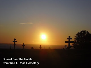
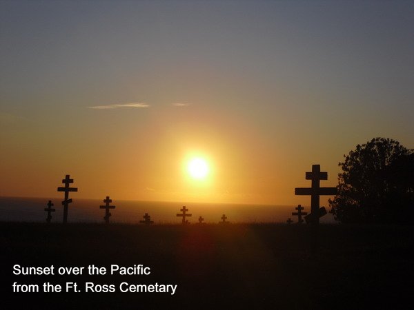
The whole day had been beautifully clear with mild temps, and even a light breeze out of the north (a tailwind - yes!) The terrain was still relatively tough – always some degree of up or down, and as described yesterday, there were lots of those fingers of water that poked inland, creating short but steep descents and ascents. As evening approached, I found a reasonably good stealth campsite at 4:45pm (N38 30.870’ W123 14.408’). This site seemed to be an historic cemetery, perhaps associated with the historic fort complex (Ft. Ross, as I found out later) several hundred yards to the north, across a ravine. It had odd-looking crosses to mark the graves. There weren’t any signs saying ‘keep out,’ or ‘private property,’ or anything else, and there was an opening in the low picket fence that I could *just* barely squeeze my trike through, which I did. I then waited about 15 minutes to watch the sunset on the ocean. I could hear children playing at the fort, but it was several hundred yards away, and I didn’t see any lights from buildings, or any people, so I figured I was pretty safe, there. There were clouds on the horizon, so even with binoculars, I only saw some hints of the green flash as the Sun went below the somewhat sharply defined clouds. I continued to wait about another 20-30 minutes for it to get darker before setting up my tent as far from the road as possible, without making myself too visible to the caretaker occupants of the fort. I finished setting up at 5:50pm and hopped in by 6pm to munch, drink soda, and finish my book (this one was a pretty quick read). I now had less than 90 miles to San Francisco, which meant doing two 45 mile days, if I took it slow and easy. If I went my usual pace, I could probably make it back to my Start Point by late morning or early afternoon of Saturday, November 14th. I would wait until most of tomorrow to verify my progress, before getting online to post my ETA for the hoards of my adoring fans (all ten of ‘em) who wanted to be there when I arrived.

Day Two Hundred Fifty-six, 091111 - Albion, CA

Day Two Hundred Fifty-six, Date Wednesday, November 11, 2009
Time in Saddle: 5:50
Distance for the Day: 54.48 miles From Westport To Albion, CA
Accumulated Trip Distance: 12,457 miles
Altitudes: Starting/Ending 1208’/19’ Highest: 372’ Accumulated: 1038’
Speeds: Avg: 9.3 mph, Max: 37.1 mph
Weather: 44°, solidly overcast, but no rain
Expenditures: $16

As ususal, I woke up at various times throughout the night and morning. I really woke up at 6am, and got up at 6:30am. I packed up my gear, and was ready to roll by 7:10am. I had a quickie breakfast of meat and cheese stick and Pay Day bar, before starting out, heading towards the Pacific coast. I had stopped and camped last night a bit past the peak of this coastal mountain range, so I started today with a fast roller coaster ride of several miles downhill (wheee!) before reaching the coast at 9:45am. I stopped a few miles down the coast at the first mini mart I found for a second breakfast of choco milk and Danish ($5) (things are pretty expensive on the coast). Now that I could see the sky, again, I noticed a medium-thick, high overcast; the Sun shone faintly through it sometimes, but not a patch of blue. The terrain along the coast was a lot flatter – there were still *some* meager hills to contend with, but nothing major. However, every time there was a spot along the coast where a finger of water poked into the land, the road would always follow the outline of that ‘finger,’ and turn inland, go steeply downhill, turn sharply around the tip of the finger, and go steeply uphill, before following along the coast, again. There must have been dozens of these, and they were a pain, as in, “ouch!” me poor legs. The real insult was not being able to use the momentum gained from doing the downhill speed-up, due to the sharp turn back out towards the ocean. I had to brake to make the corner, I’d flip the trike. A tour-loaded bicycle would perhaps do a little better in these instances, but not by much, I don’t think.

I got to Ft. Bragg at 12:45pm, and stopped to have a Subway meal deal ($8) while I charged up my notebook and answered email (there was a working wi-fi signal there – I love it when that happens). I left at 3pm, and continued down the coast, stopping once to get a bit more food and drink for the evening ($3)
I kept going until after sunset before looking for a stealth camp location, and at 5:15pm, I saw a ‘coastal access’ sign on a side road, so I took it down a few hundred yards. I figured it must be a dead end, so there should be no or little traffic, and found a flat, level spot on the grass at the side of the road next to the Navarro River to set up my tent (N39 11.798’ W123 45.053’). I was set up, cloaked, and inside with munchies, soda, and book by 5:47pm. Two cars did pass by, heading down, but that was it for the night (that I noticed). I was about 5 miles north of Elk, and figured if I could keep up my current pace, I should make it home by this coming Saturday or Sunday. That was a bit of an odd concept to grasp, mentally. Done? Finished? Over? Nahhh! Yeah!

Day Two Hundred Fifty-five, 091110 - Westport, CA

Day Two Hundred Fifty-five, Date Tuesday, November 10, 2009
Time in Saddle: 5:44
Distance for the Day: 43.40 miles From Miranda To Westport, CA
Accumulated Trip Distance: 12,403 miles
Altitudes: Starting/Ending 201’/1208’, Highest: 1910’ Accumulated: 4009’
Speeds: Avg: 7.5 mph, Max: 36.9 mph
Weather: 49° overcast but without rain
Expenditures: $25

I woke and got up at 6:54am – a little later than usual for me – the late night blogging at the 3Ps must have finally caught up, but I was now fully rested. It was solidly overcast this morning, but it didn’t feel like it would rain. As predicted, the traffic noise from the local road died out late in the evening, and the noise from Hwy 101 was too far away to be of much bother, so I got a decent night’s sleep. I packed up and was ready to roll by 7:04am, and continued on through the last third of the Avenue of the Giants, which ended in Garberville. Along the way, I stopped briefly at The Legend of Bigfoot Gift Shop to get a couple of drinks, and also picked up an interesting, scallop-shaped Andean ocarina flute (I like flutes), just for the heck of it ($10), and continued on. I stopped at Garberville at 10am to get a mini mart breakfast of hot cocoa, and a couple of pre-packaged pastries ($3), and to recharge my notebook. The next time I stopped, it was at a mini mart in Leggett where I got a late lunch (burger and food/drink items - $12) at 2:20pm, and left at 3:02pm. From here, my route split off to the southwest from Hwy 101 onto Hwy 1; it was a bit of a climb – up almost a thousand feet in elevation through dense forest on narrow, winding road, before it began to go downhill, again. Traffic was very light, though, so I didn’t have any problems.

At 4:50pm, I found a stealth camp on the downhill side of Leggett Hill; a gravel pile (I love gravel piles) in a lot off the road looked like it might have potential. But there was a trail at the back of the lot that I could ride and get still further from the road. I didn’t go very far – just far enough to be well hidden from the road (N39 48.659’ W123 47.343’). Traffic was light, and would get lighter as it became darker, so the noise level would be minimal. I set my tent up on a moist carpet of pine needles, and hopped inside by 5:15pm with munchies, soda, and book. I read until about 9pm before saying goodnight to myself. This was a nice site, as I could read without worrying about anyone seeing my light. Also, this site was almost disturbingly quiet. No sound at all. No wind, dripping water, birds – no nothing! I felt like I was in a soundproof studio – very odd, indeed. In fact, it was a bit spooky, but in a good way.

My legs today and yesterday were a fair bit more painful than usual with the somewhat heavy climbing, today; I just had to kind of grin and bear it. I would have thought they would be better after having rested a few days, but I think I’m noticing a trend that whenever I stop cycling for more than 3 or 4 days, starting back up again is a painful process. The pain was from the muscles, not the knee joints, so the usual leg stretches didn’t help. Maybe just before I finish, I’ll figure out some quick and easy solution for the relief of muscular pain. Oh, this was a little disappointing: before hitting Leggett, I saw a highway sign that said, “199 miles to SF” (progress – yay!), but later, after going past that sign at least 5 or 10 miles, once I got onto Hwy 1 heading for the coast, I saw another sign that said, “208 miles to SF.” Anti-progress – phooey! This must have been a longer route – not too surprising, as coastal routes tend to wind around a bit more than inland routes – but still.

Day Two Hundred Fifty-four, 091109 - Miranda, CA

Day Two Hundred Fifty-four, Date Monday, November 9, 2009
Time in Saddle: 6:37
Distance for the Day: 64.12 miles From Arcata To Miranda, CA
Accumulated Trip Distance: 12,359 miles
Altitudes: Starting/Ending 376’/201’, Highest: 431’ Accumulated: unknown
Speeds: Avg: 9.6 mph, Max: 32.1 mph
Weather: 53° light, intermittent rain throughout most of the day
Expenditures: $2

Packed my trike back up, got and gave hugs, and said my goodbyes to the 3Ps. That was the first time I’d ever visited them in Arcata, though they’ve been there for more than a decade. It’s such a nice place, I’ll definitely have to visit more often. By 8:28am I was just about ready to leave and of course, it started to rain! However, I was almost glad, because it gave me a chance to try out the new, lightweight Kokatat kayaking jacket I’d just bought. It wasn’t too bad – the rain was light and intermittent, but when it did come down, the jacket’s rubberized and Velcroed seals around my neck and wrists worked quite well to keep the water from seeping into and soaking my shirt. Of course, since the design was a zipperless, waterproof pull-over with sealed neck and cuffs, I got a little steamy underneath it from my exertions, but nothing like the soaking wet of seeping rainwater. Whenever it wasn’t raining, I’d open up the collar seal and get a bit of flow-through ventilation, which helped keep me from getting drenched by my own sweat. (I would have liked to have tested this garment further, but wouldn’t you know it: that was the last rain I would get for the rest of the trip.) The only thing I purchased this day was a soda ($2) which I saved for the evening.

Not long after leaving Arcata and Eureka, I hit the town of Fortuna, and the beginning of the Avenue of the Giants, so called because the highway runs through a forest of giant redwood trees – the largest remaining stand of virgin redwoods in the world, in fact. It was very beautiful, even in the rotten weather, even though I was seeing it from the highway – an amazing forest of gigantic trees, some more than three hundred feet high. I had plenty of time to look at them, as the route was mostly rolling hills – this being a major highway, they weren’t steep, but could be long. On the uphills, my goggles would fog up, so I just took them off – the Sun wasn’t shining, and there wasn’t any wind, to speak of. No reason to be half blind in the middle of all this natural beauty.
The day ended in a pretty heavy overcast, so I couldn’t quite tell when sunset was, but it started to get significantly darker at 5pm, so I began to look for a turnoff from the highway so I look for a stealth camp. I took an exit just past Miranda, and went up a short, steep, dead-end road. There were some semi-trashy looking houses nearby, and the road ended at a couple of gates. Nothing really great, here; the possible places to set up were exposed, and not even very level. You definitely want mostly level when sleeping on the ground – otherwise, you have this nasty tendency to slide to the downhill side of the tent. I rode back down, crossed under the highway, and headed south a few hundred yards on a side road, which then crossed a short bridge over the Eel River. I saw that most of the riverbed was dry gravel, and thought I might be able to find someplace by the river to set up. It was a good 40’ feet below me, though, and so any nearby access to it would probably be pretty steep. Right after the bridge, there was a steep (told ya) dirt and gravel road that led down to the river. Just past the entrance to the road on the side, though, was a small, level patch of grass. Hmmm! The spot was still somewhat visible from the road, and car headlights would sort of glance off me, but I don’t think anyone would notice my presence, especially once I cloaked my trike. So, at 5:10pm, in the gathering gloom of early evening, I set up on that spot (N40 13.090’ W123 48.921’), hopped inside at 5:48pm, recorded the end-of-day stats, munched trail mix, drank soda, and read my new Robin Cook book, Mutation, until 8:30pm before getting too drowsy to continue. I was pretty tired from all the late nights of blogging the past few days, so I slept quite well. There wasn’t any rain, at the moment, but the trees overhanging my tent dripped a bit – not too bad. It rained a bit more during the night, but it was light, and by the wee hours, it stopped completely, and only the drips from the trees pattered down. I was awakened by a bit of rain during the night, but it was brief, and didn’t keep me up.